
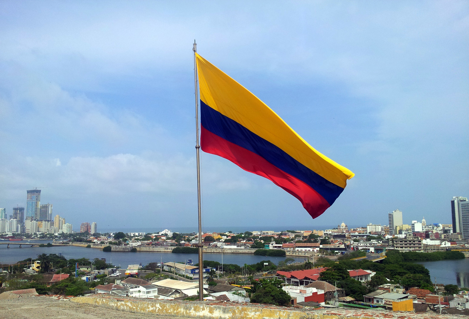
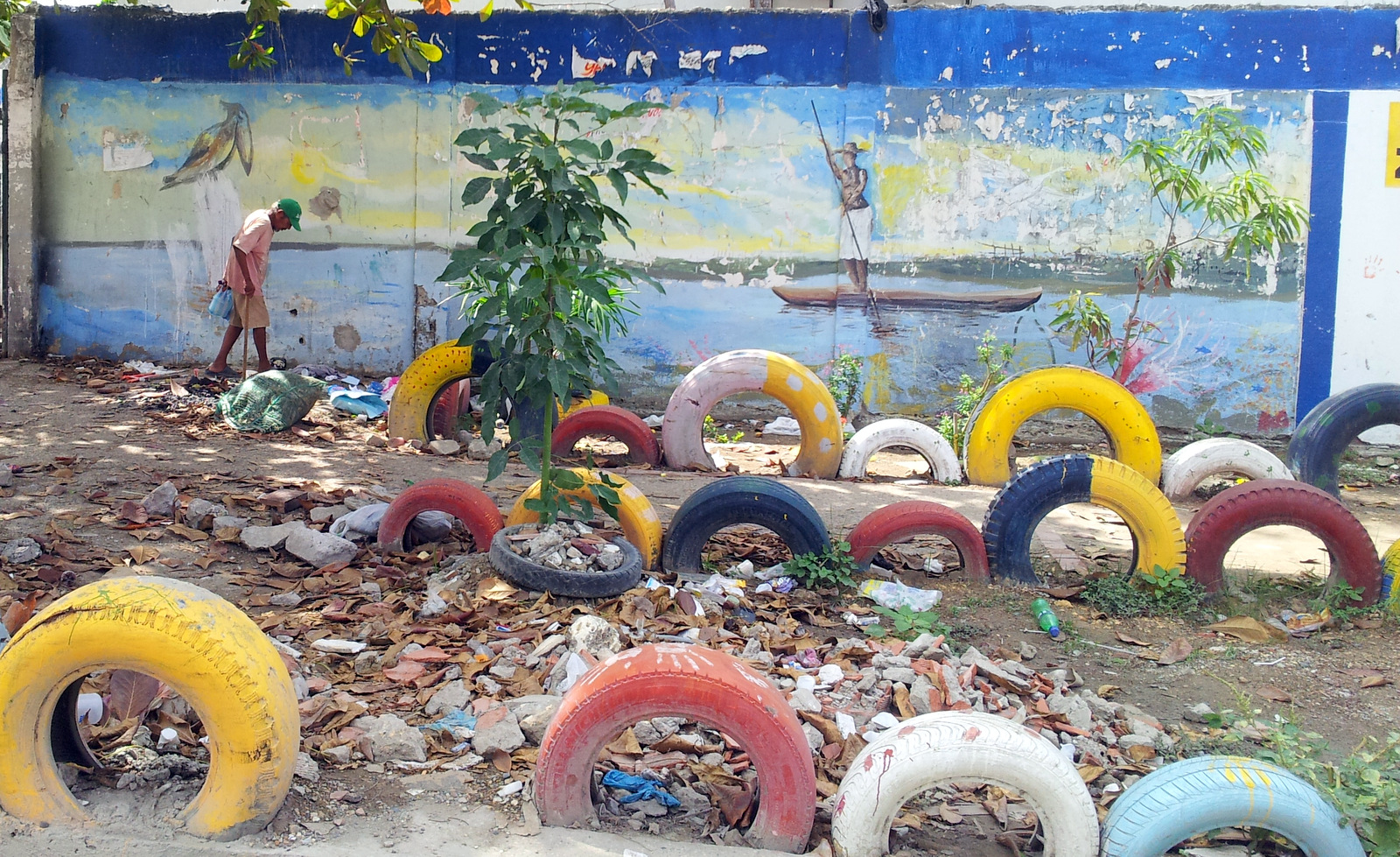
Cartagena
On the 15th of July we set sail for Colombia, said good-bye to the North American continent and the next morning we had Cartagena on the horizon. Buenos Dias South America! We disembarked in Cartagena harbor – but not our vehicles.
It takes a few days to get your vehicle back, more paperwork and waiting. I marched behind Michael from station to station and back while Vroni and Günter had to wait for us. You are required to buy life insurance in order to enter the harbor. It is a good idea to bring along some reading material for the longer wait periods.
Cartagena
The Hotel Artelleria in Getsemani was our home for a week, a nice place in walking distance to the historic town and a save parking lot just around the corner. They had A/C, a small rooftop pool and lots of fruit for breakfast.
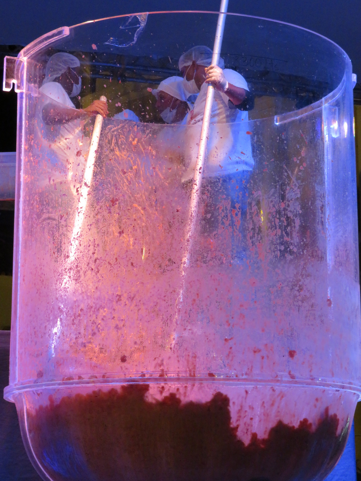
The worlds biggest shrimp cocktail.
One day when we wandered around town, we watched as a crowd gathered on a plaza. Up on stage there was a huge see-through round container, speeches were held and boxes and boxes of cooked shrimp were dumped into this container, salsa was poured and more speeches and shrimp added. Finally everybody lined up for a cup of shrimp cocktail. Not until the next day did we find out that they had broken the Guinness World record (held by Mexico) and created the biggest shrimp cocktail ever. So much for our Spanish.
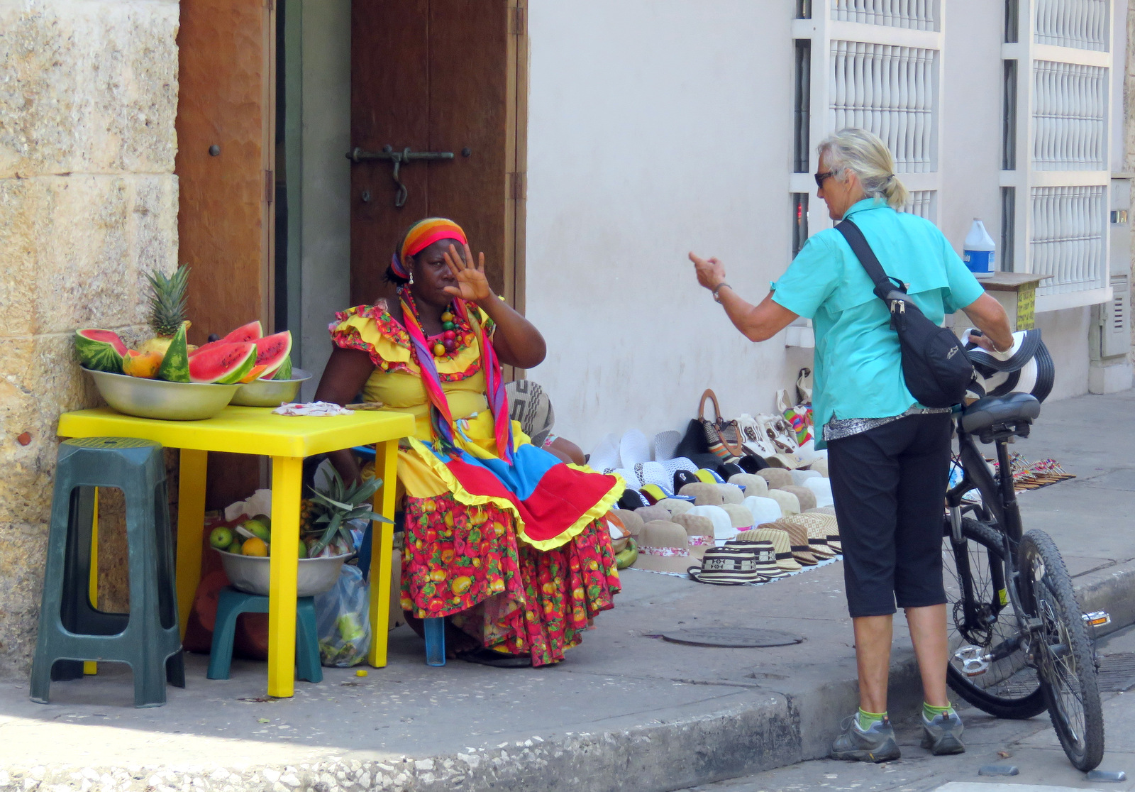
We bought some ice cold watermelon.
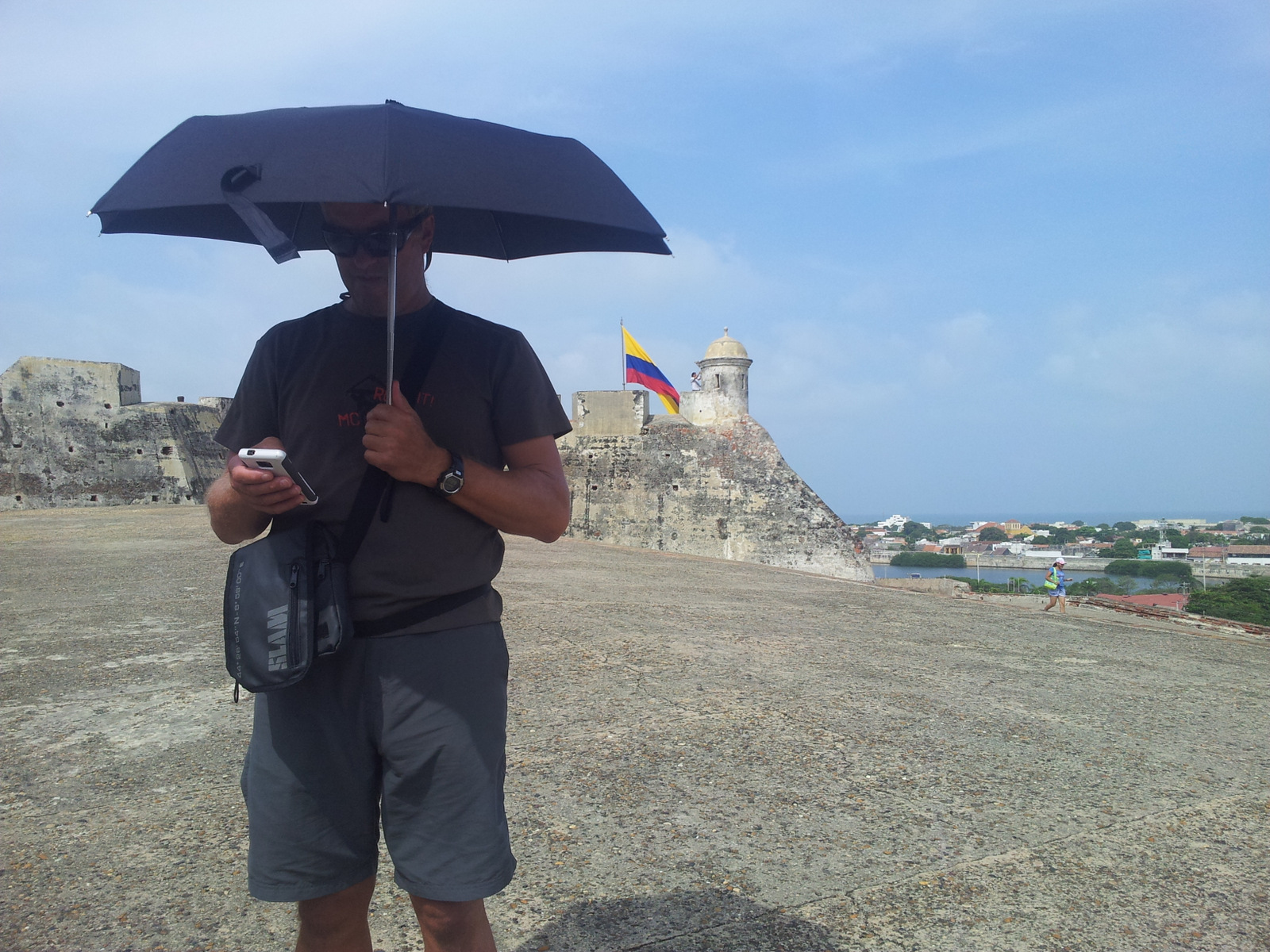
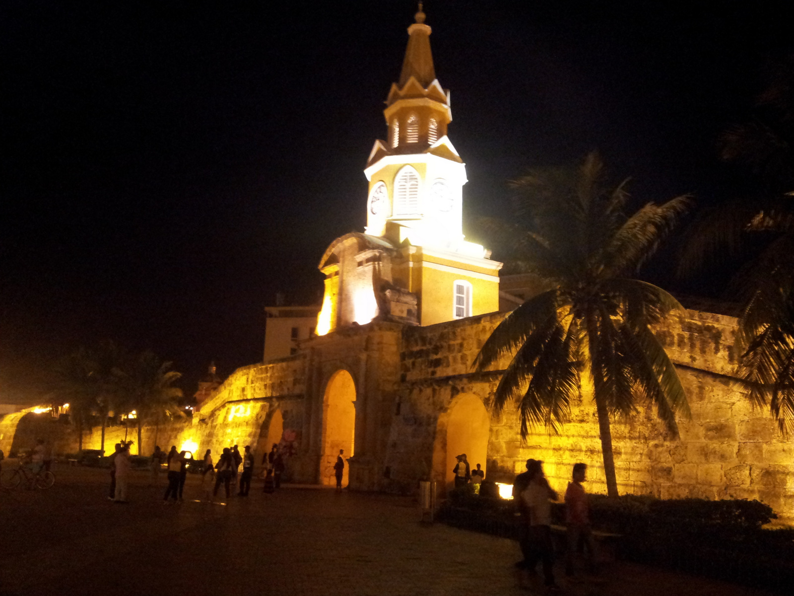
On the fort, so glad we brought our umbrellas.
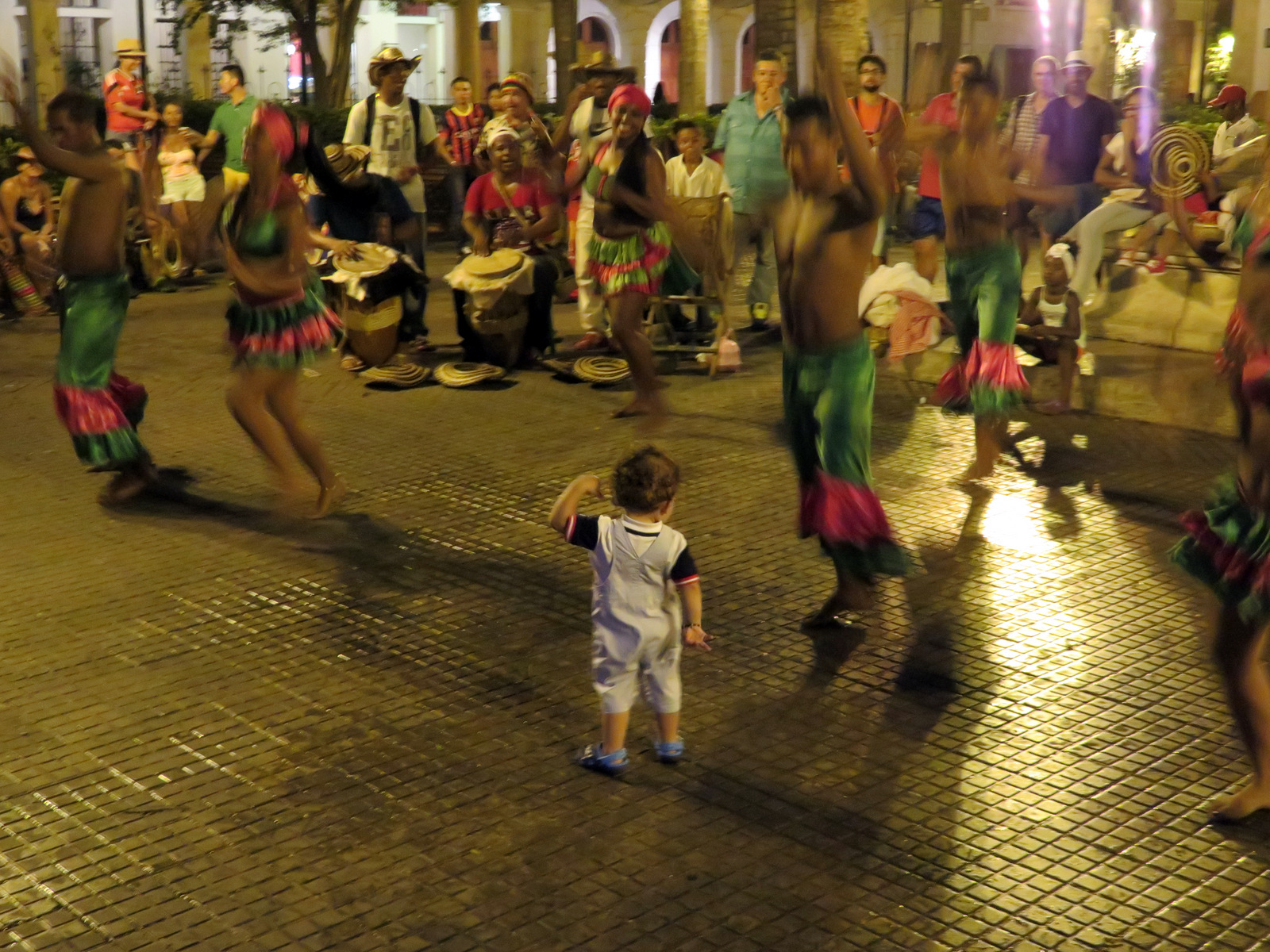
We rode the bicycles around town on Sunday morning, along the wall and through the little streets, went to a museum and all the churches. The following Monday was Independence Day with a parade, music and dancing.
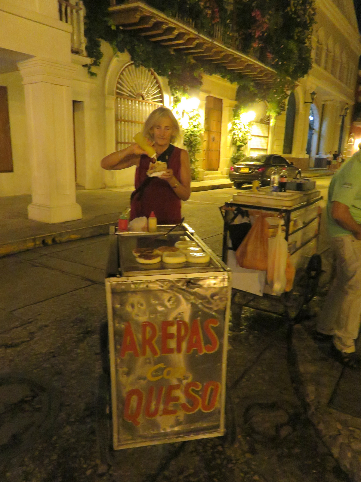
Cheese filled arepas for dinner, this one I topped with pineapple syrup.
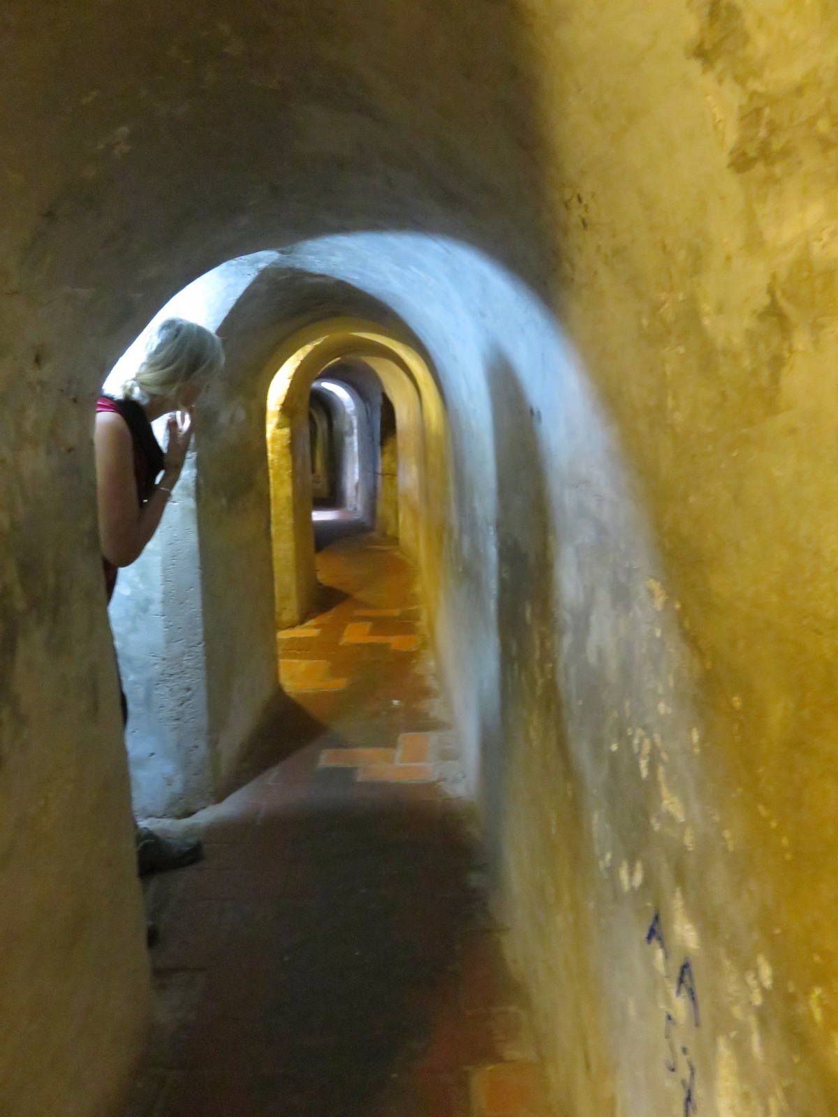
Getting lost in Castillo San Felipe
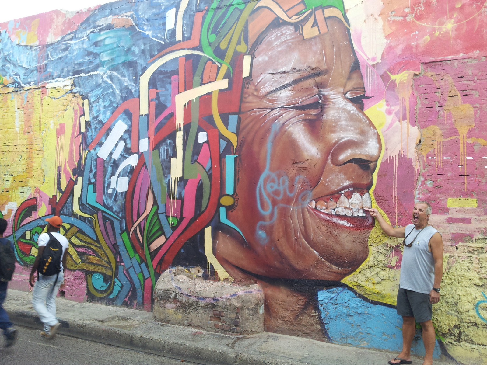
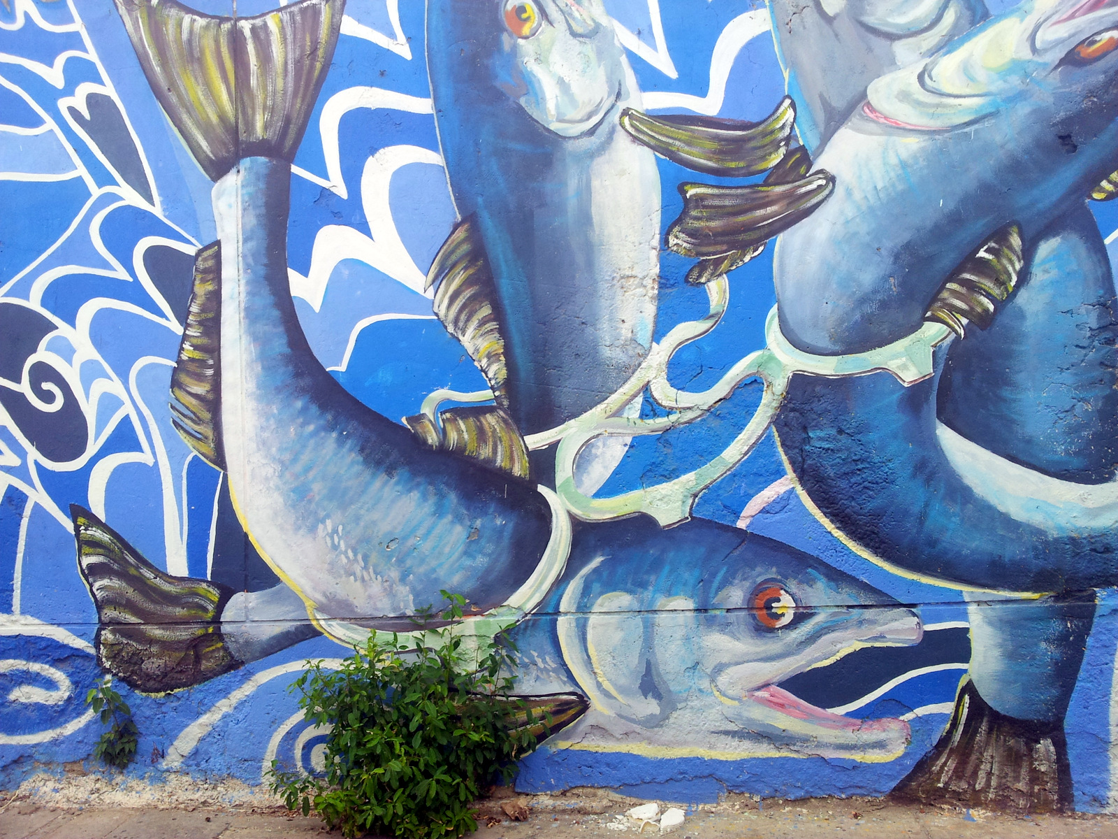
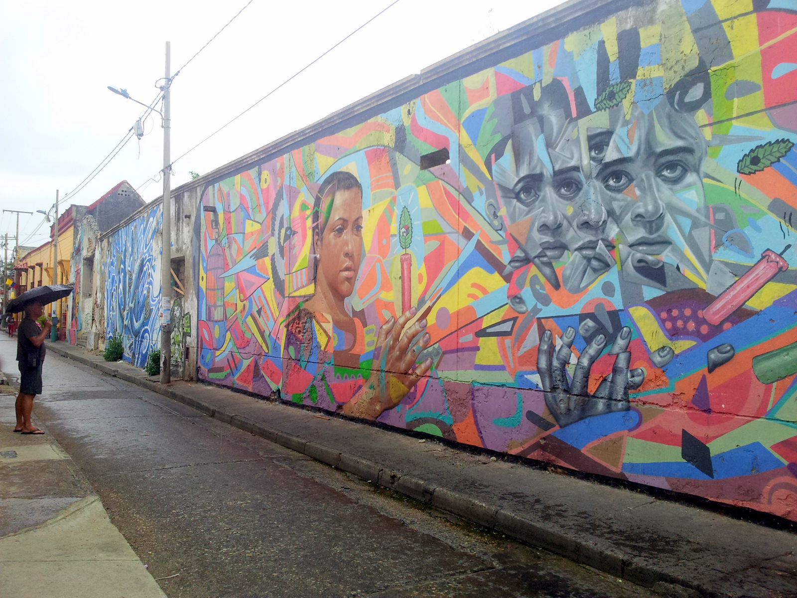
Murals around town:
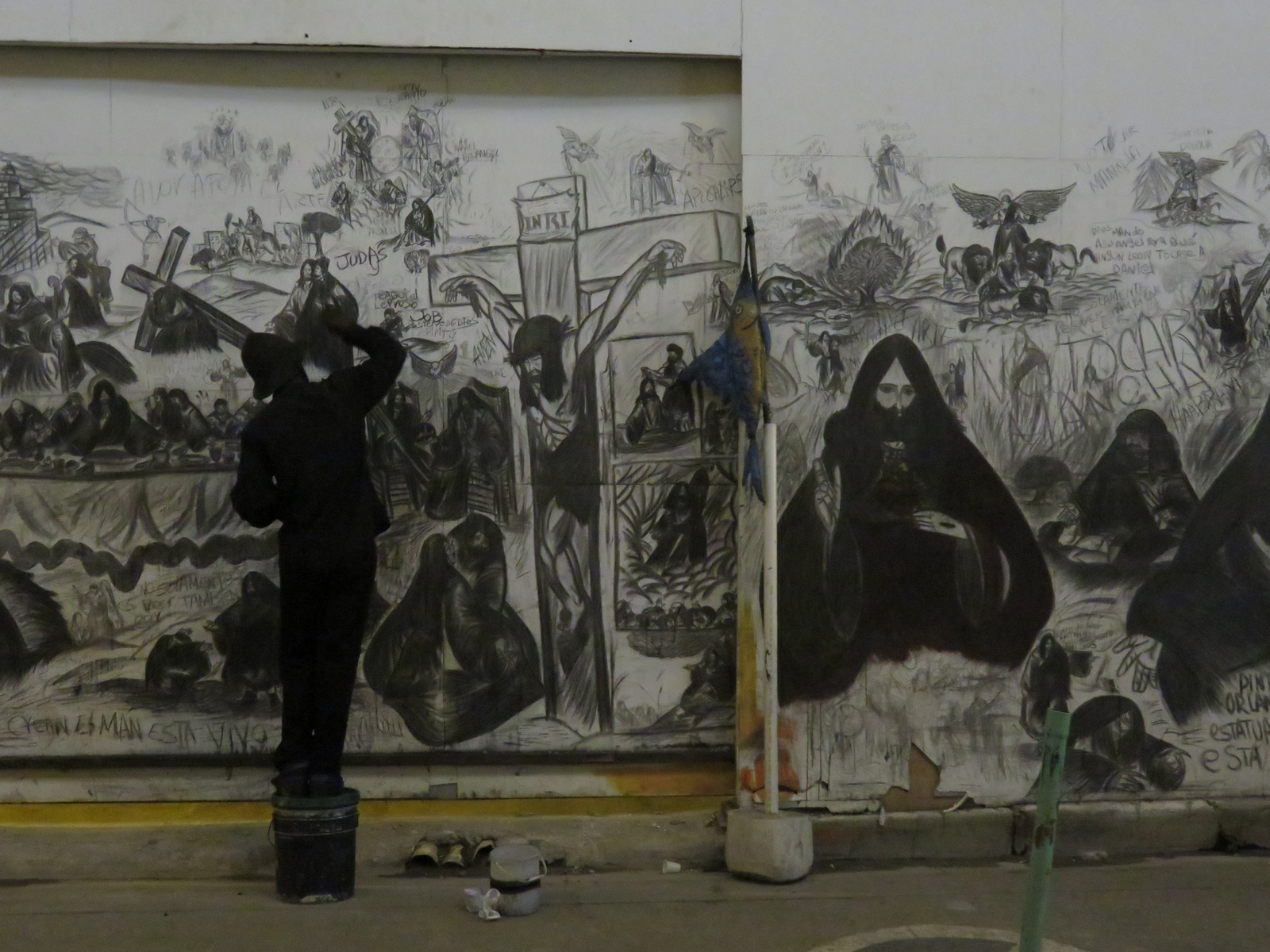
He only painted at night….
Ohne Worte 🙂
Colombian salmon?
Soon we had enough of city life, said good-bye to Vroni and Michael and took off for the Caribbean part of Colombia.
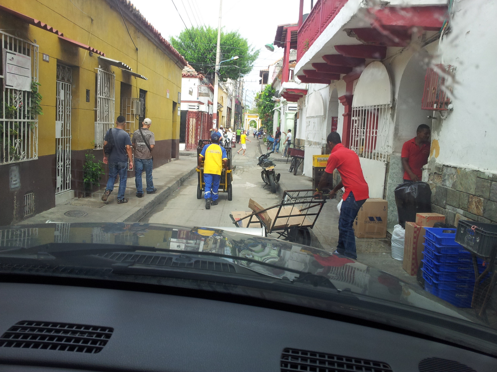
Trying to find our way out of the city.
Sierra Nevada de Santa Marta
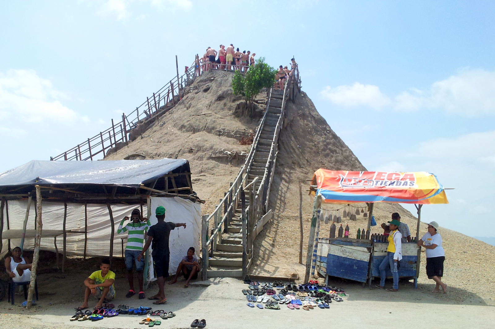
On the way there was a famous tourist spot were you can take a mud bath on Volcano del Totumo, a so-called “mud volcano” we wanted to check it out but split the scene when we saw several tour buses idling (to keep them cool) and swim suit clad tourists queued up from below and all the way up to the mud hole which is located on top of a dirt cone. For a fee you can wallow in the mud, it did not look very inviting.
Mud volcano
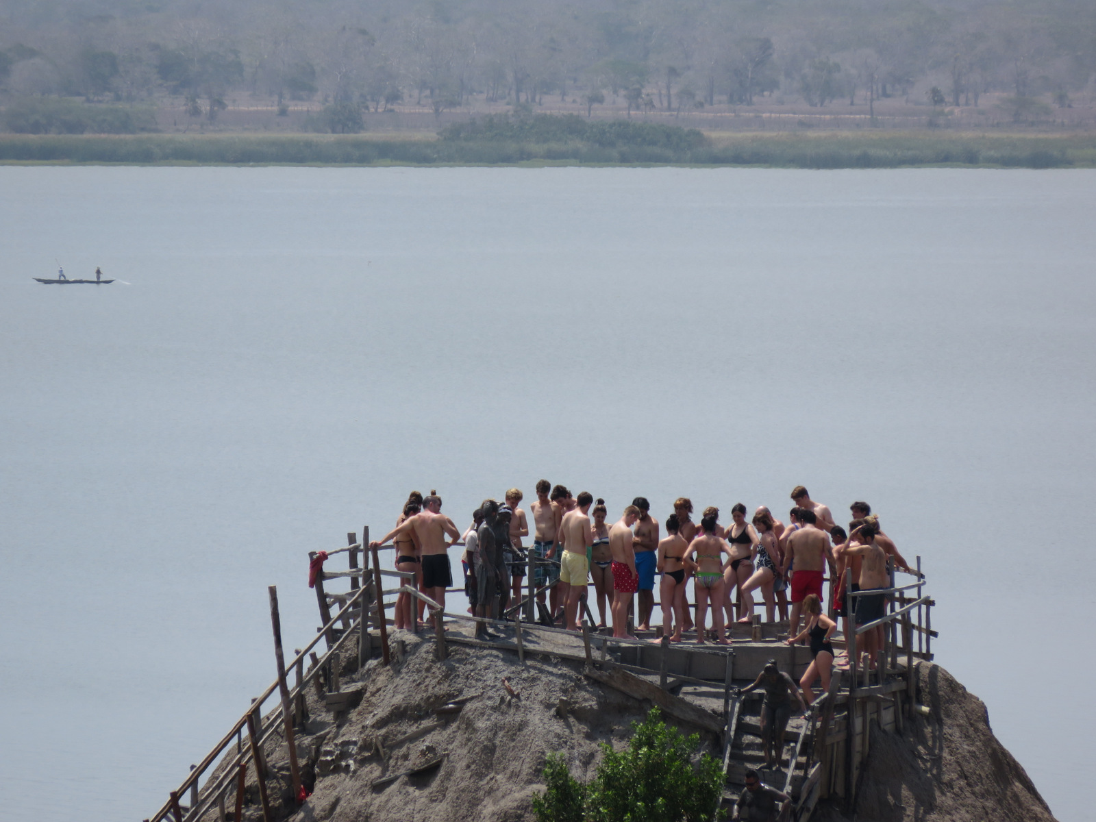
Go for it!
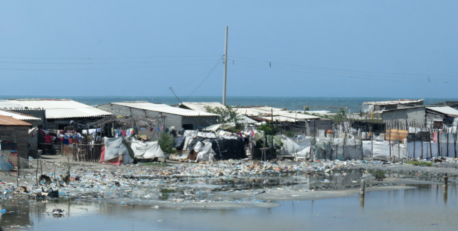
We drove on, through Barranquilla, the town was choked with trucks and slums and garbage, we needed some peace and quiet and wanted to get away from more of the same and the heat.
A little blurry because it took it through the car window, the other side of the beautiful Caribbean.
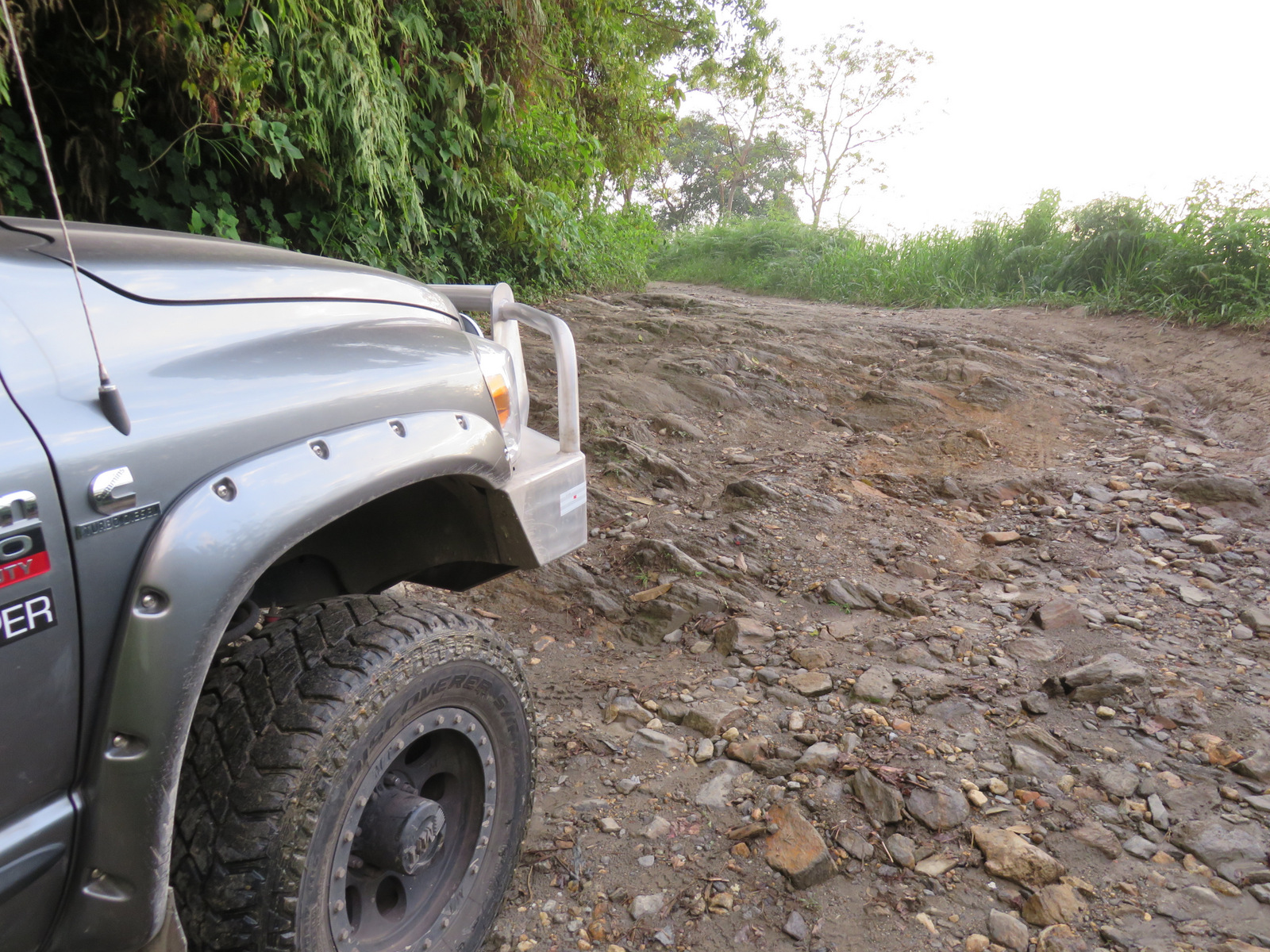
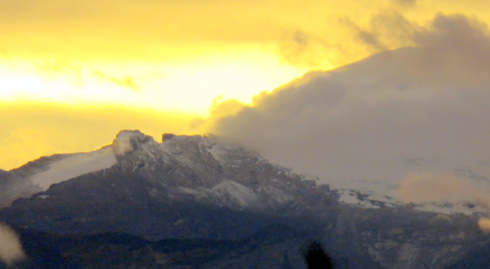
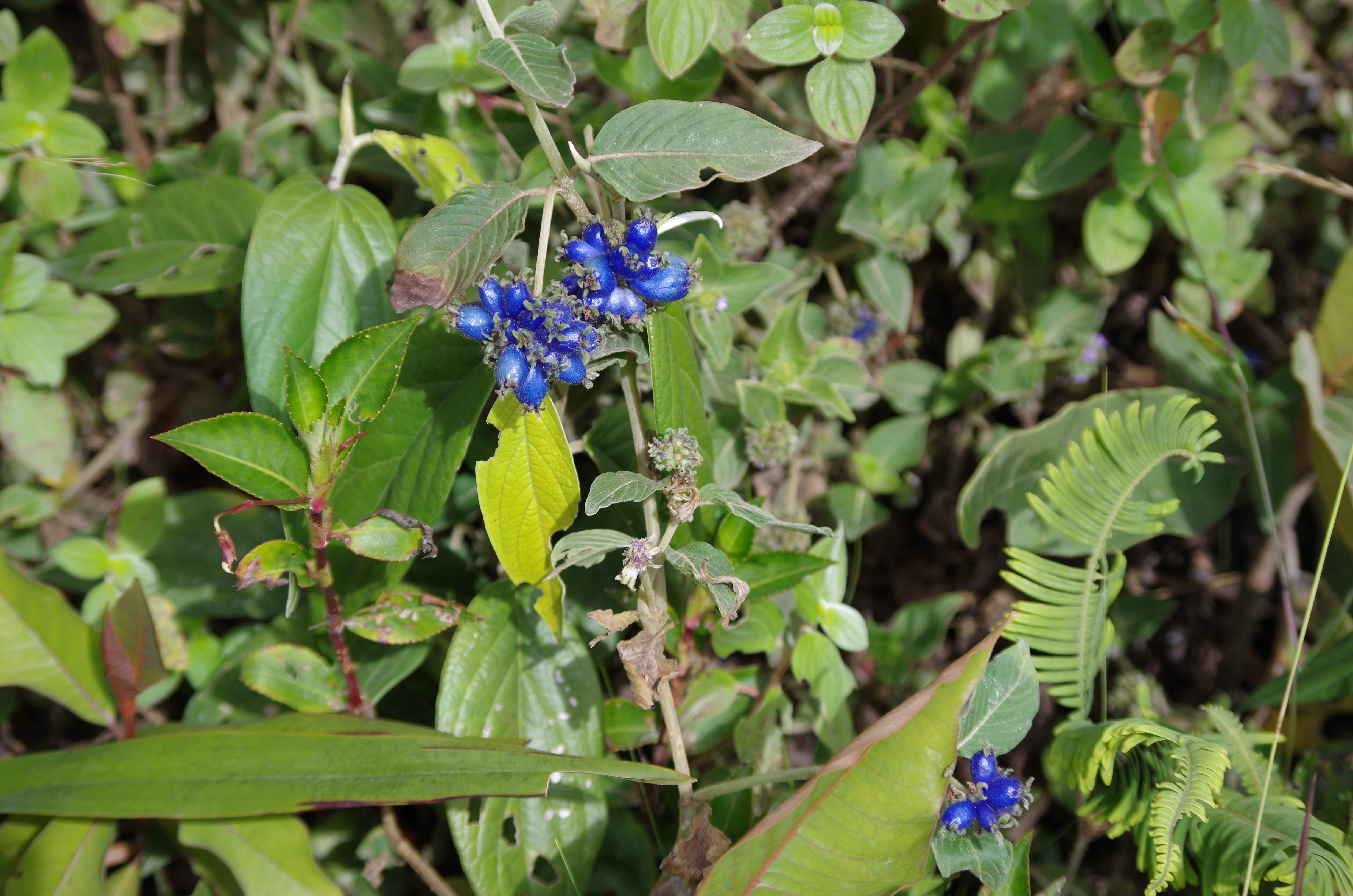
So we skipped the beaches there and drove up to the cloud forest of the Sierra Nevada mountains hoping to be able to find cool air and something tranquil to spend a few days. Most of this area is a national park and most of it is closed off for hiking or exploring. It is the home of around 30 000 indigenous people, descendants of the Tayronas and holds many sacred sites including Ciudad Perdida (older than Machu Pichu). We drove up near the town of San Lorenzo, camped beside the road at around 1600 meters and went hiking. This road is pretty rough and should not be attempted without 4×4 and high clearance. We hiked higher on the road, the clouds rolled in and rolled out, the sun came and went, so did the drizzle. It was wonderfully wild up there, many birds that are endemic to only this mountain range inhabit the forest, we saw flocks of Santa Marta Parakeets, a keel billed toucan and numerous other birds. There are also monkeys and many other mammals, reptiles like the glass frog live here undisturbed. The highest peak is 5776 meters, most of the highest peaks are snow-covered, but we were not even close and never saw them.
Higher….
…and higher.
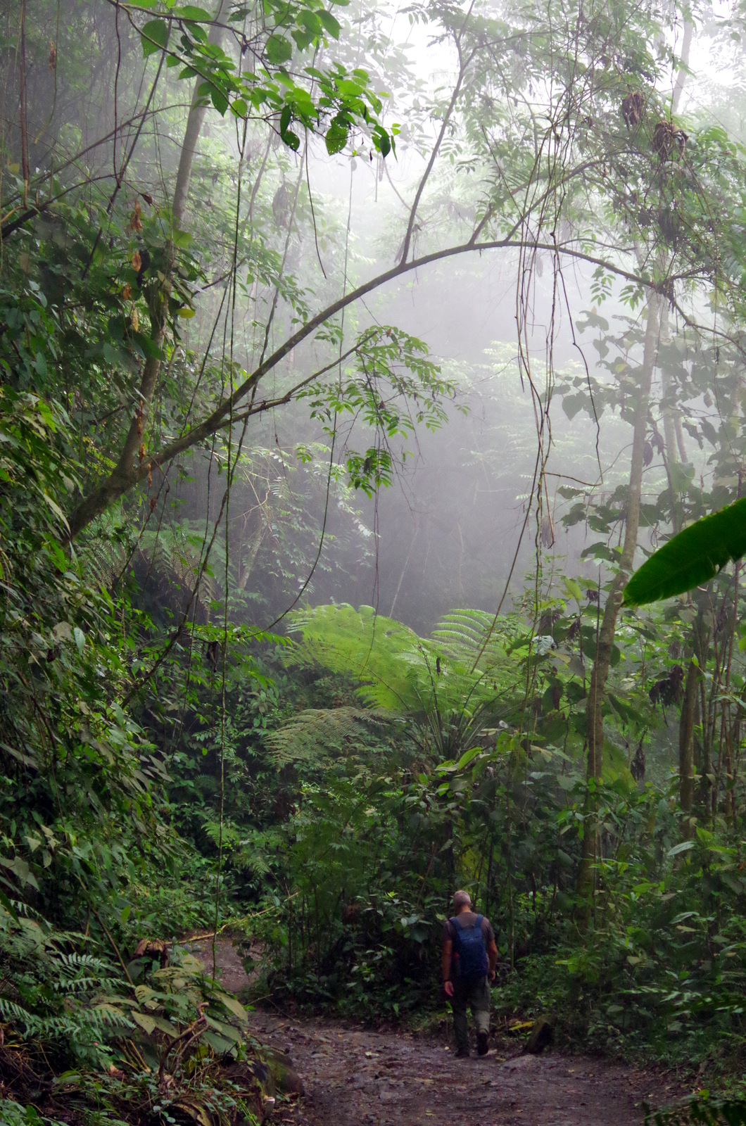
Seltsam, im Nebel zu wander! (Wondrous to wander through mists!) Hermann Hesse
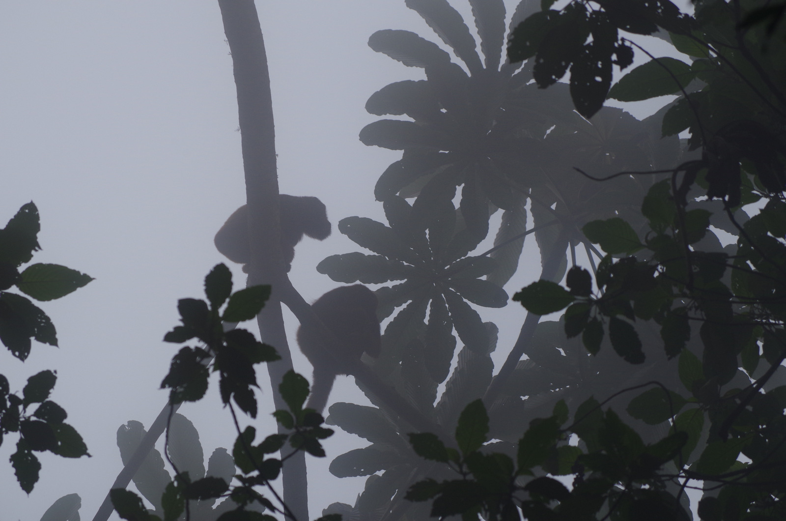
Howler monkeys hunkering down.
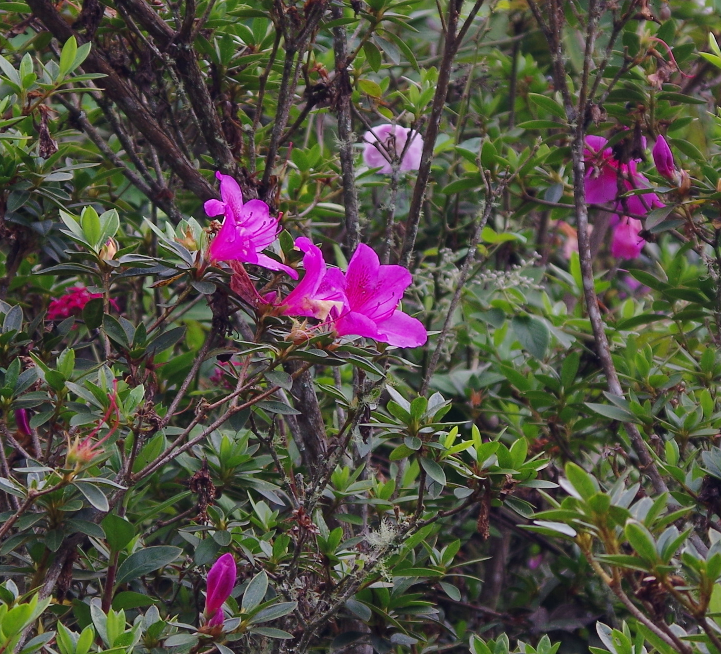
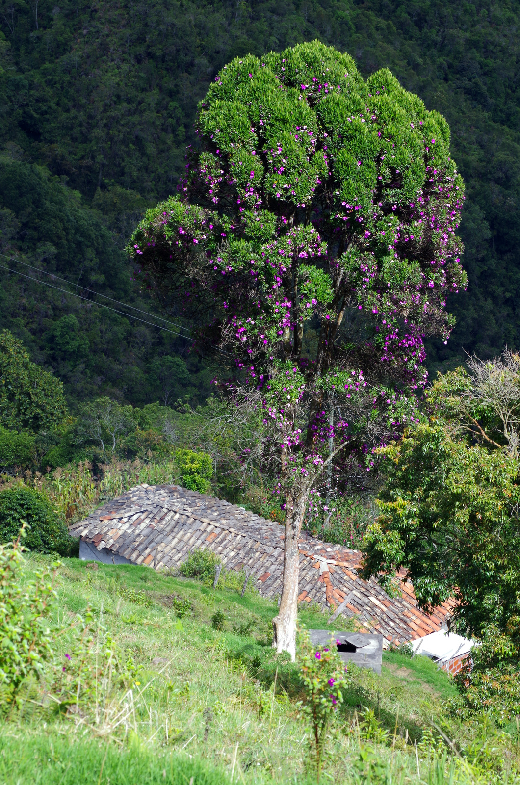
Wild azaleas.
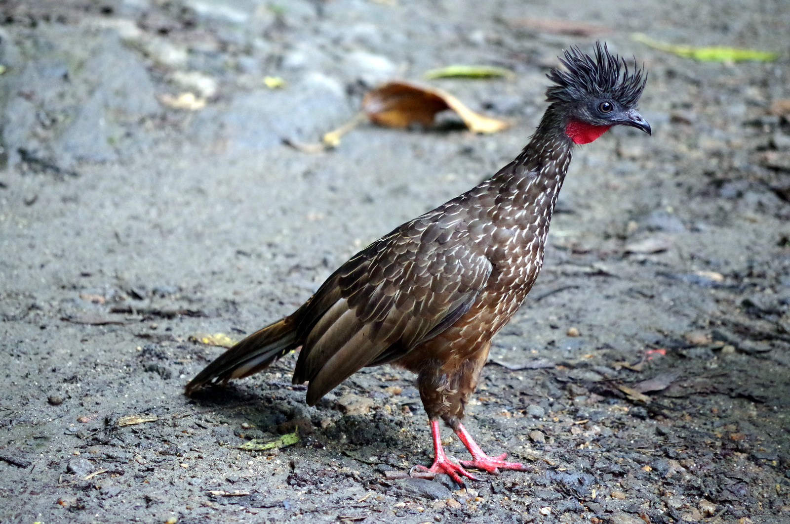
Guan
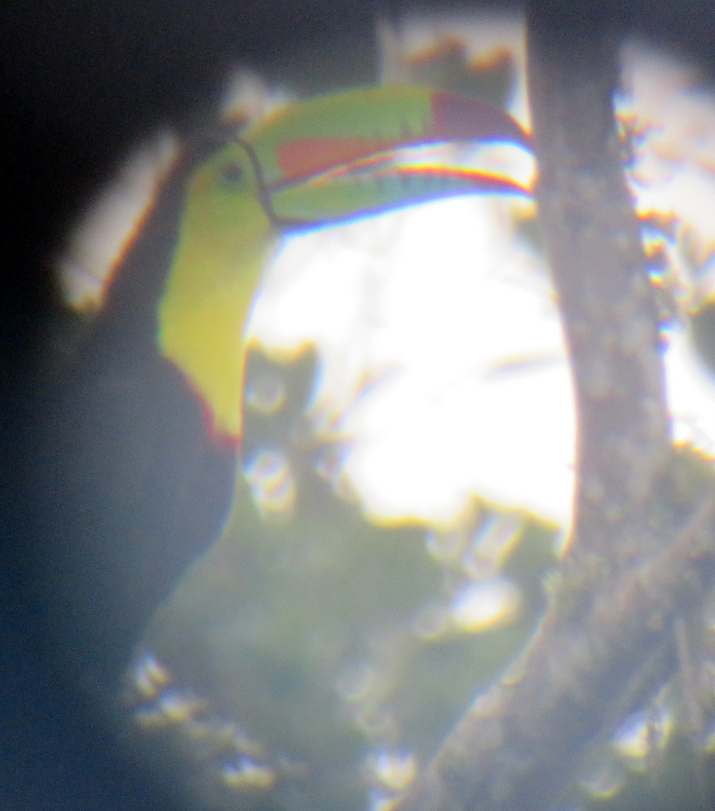
Taken with the cell phone through the scope.
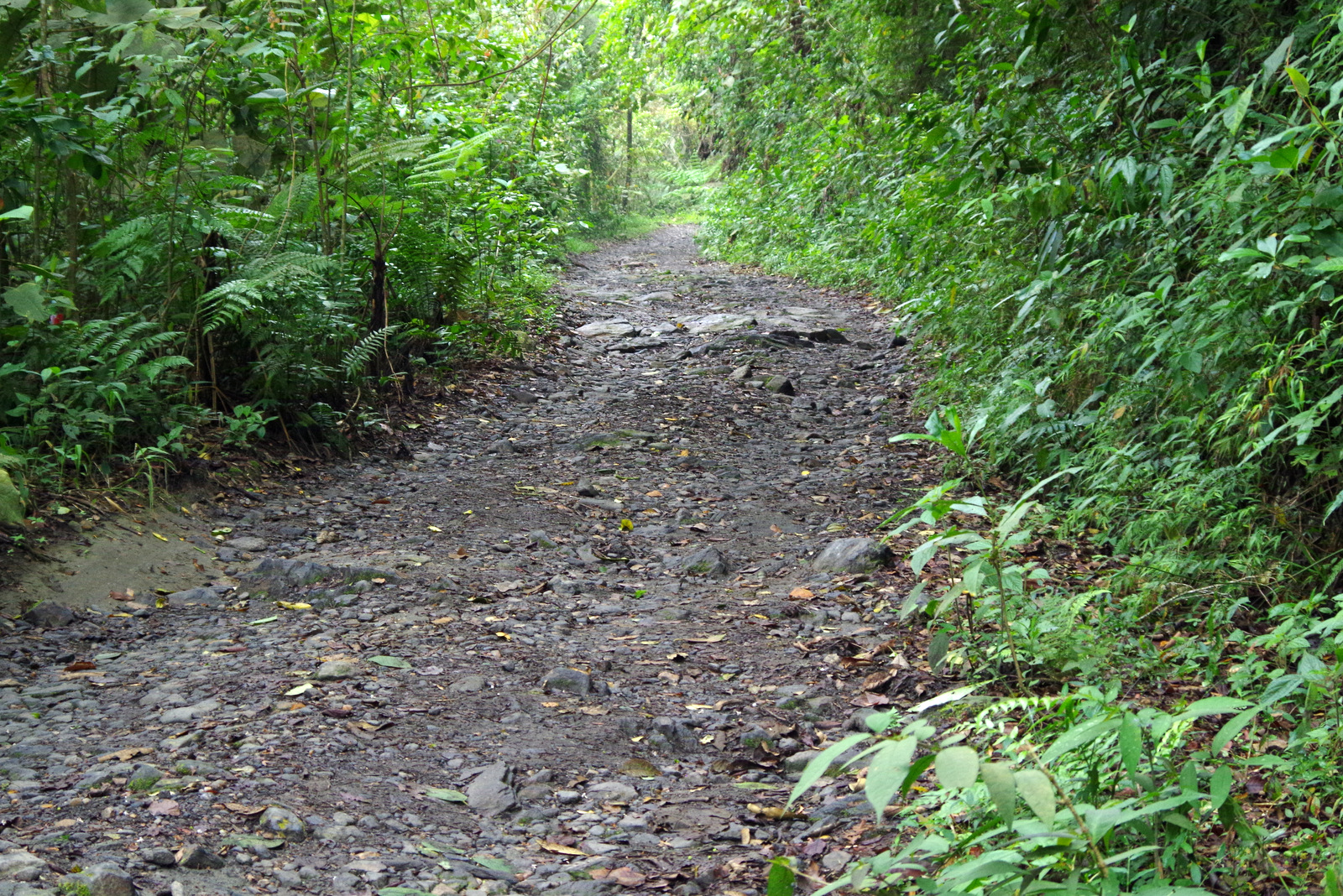
The trails go on and on.
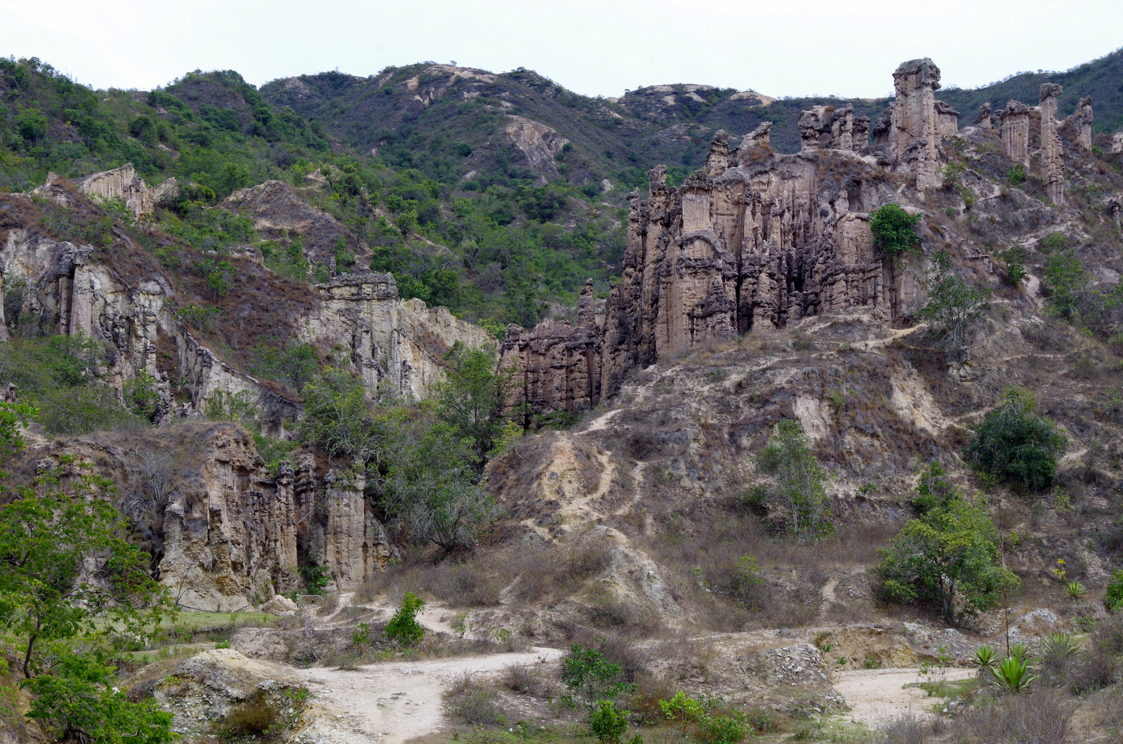
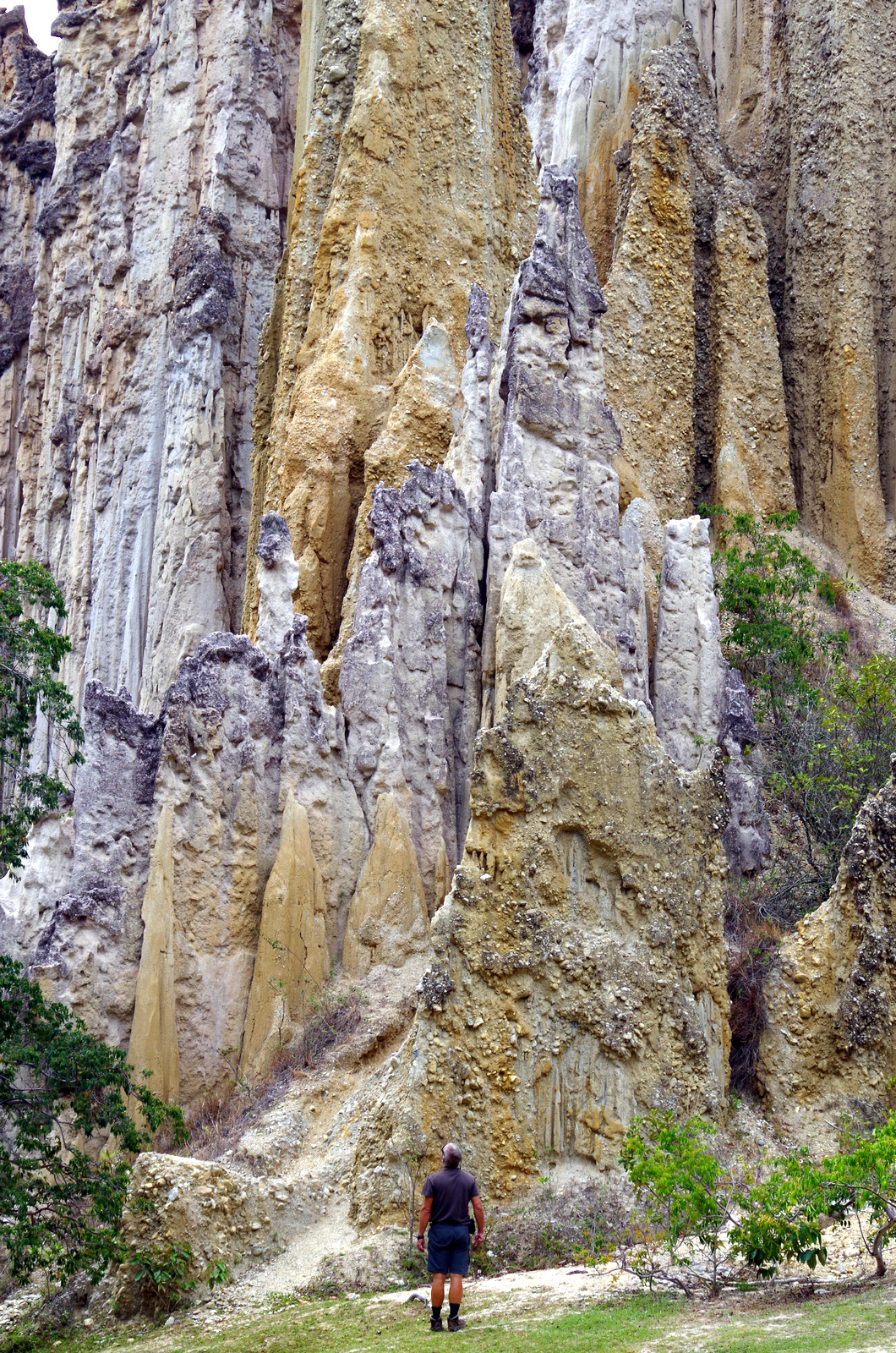
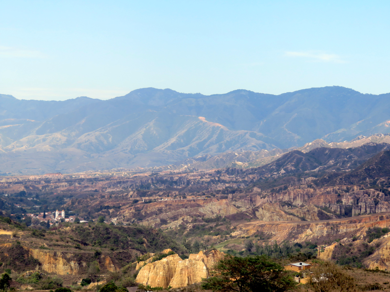
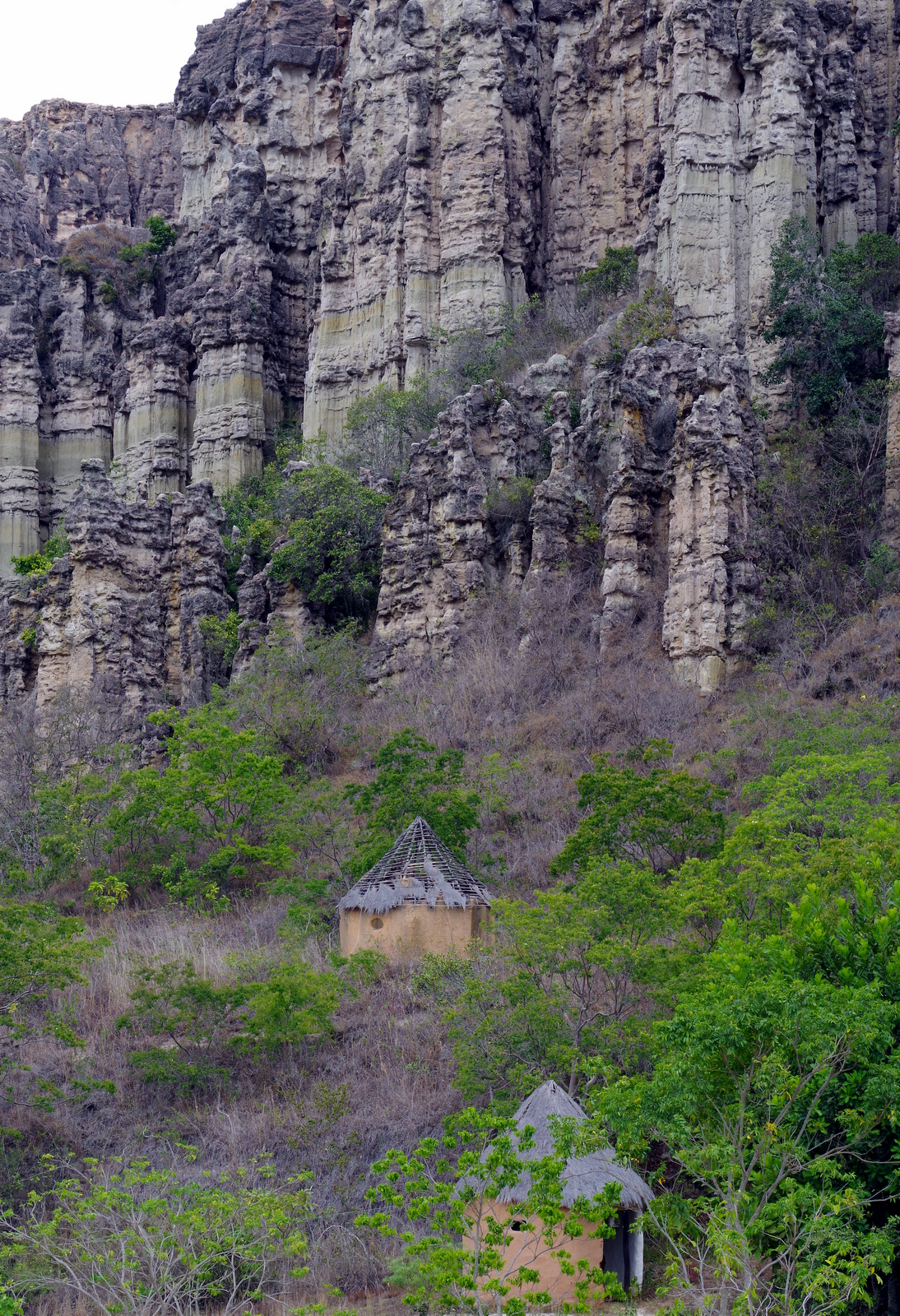
Our next destination was some unusual rock formations called Los Estoraques, east of Aguachica. It was a long haul for Günter, the traffic in Colombia is nerve wrecking, anything goes. We saw three motorcycle accidents in one day. The road from Aguachica winds up high into the mountains and is busy with heavy trucks to and from Venezuela. It got dark and we hadn’t found a spot to camp yet, finally spent the night at the edge of a cliff beside a small restaurant that caters to truck drivers. Not very quiet but we were glad to settle in for the night after a standard Colombian meal which always consist of arepas (corn flat bread like the Mexican gordita), rice, some kind of meat and fried plantain. Los Estoraques was interesting, we had to take a guide and some areas were closed to erosion, camping is not allowed because technically the park has been closed since 2010.
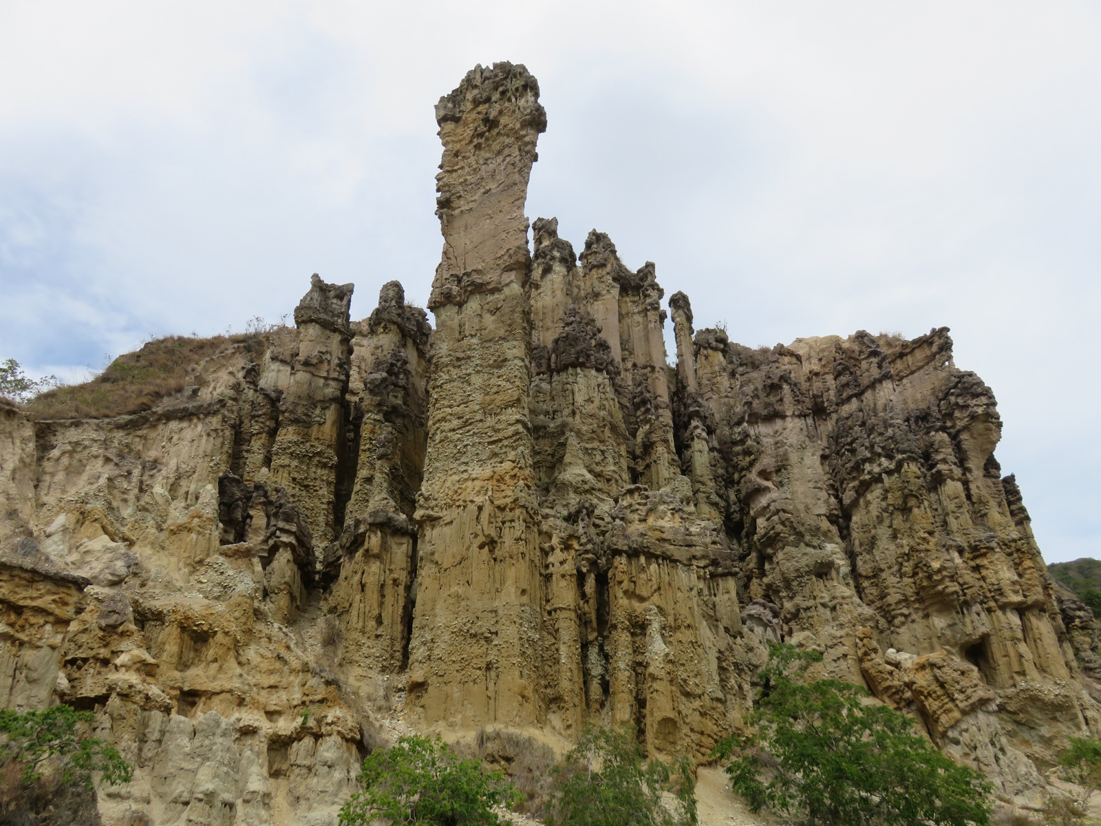
Los Estoraques
Aspacica
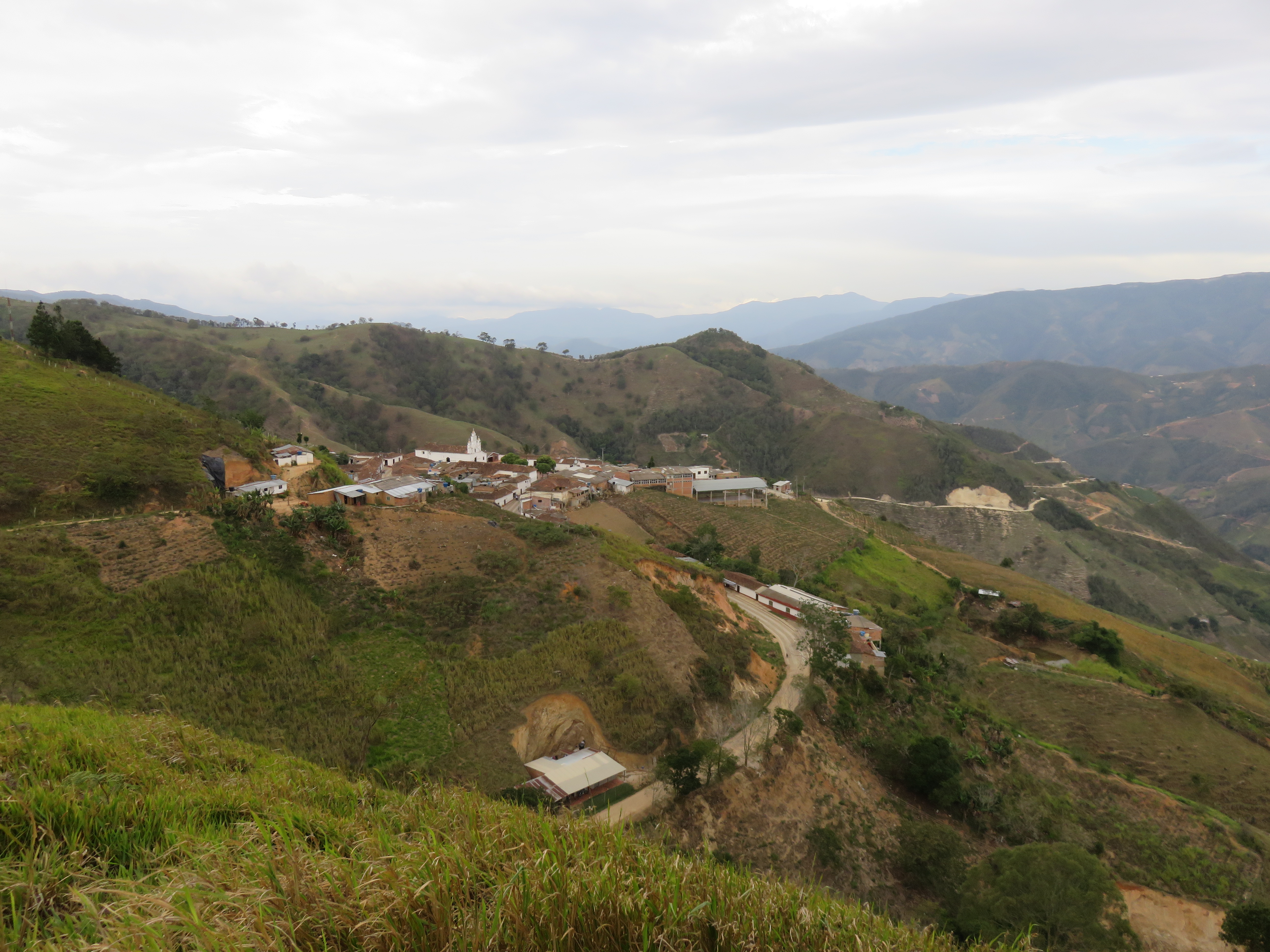
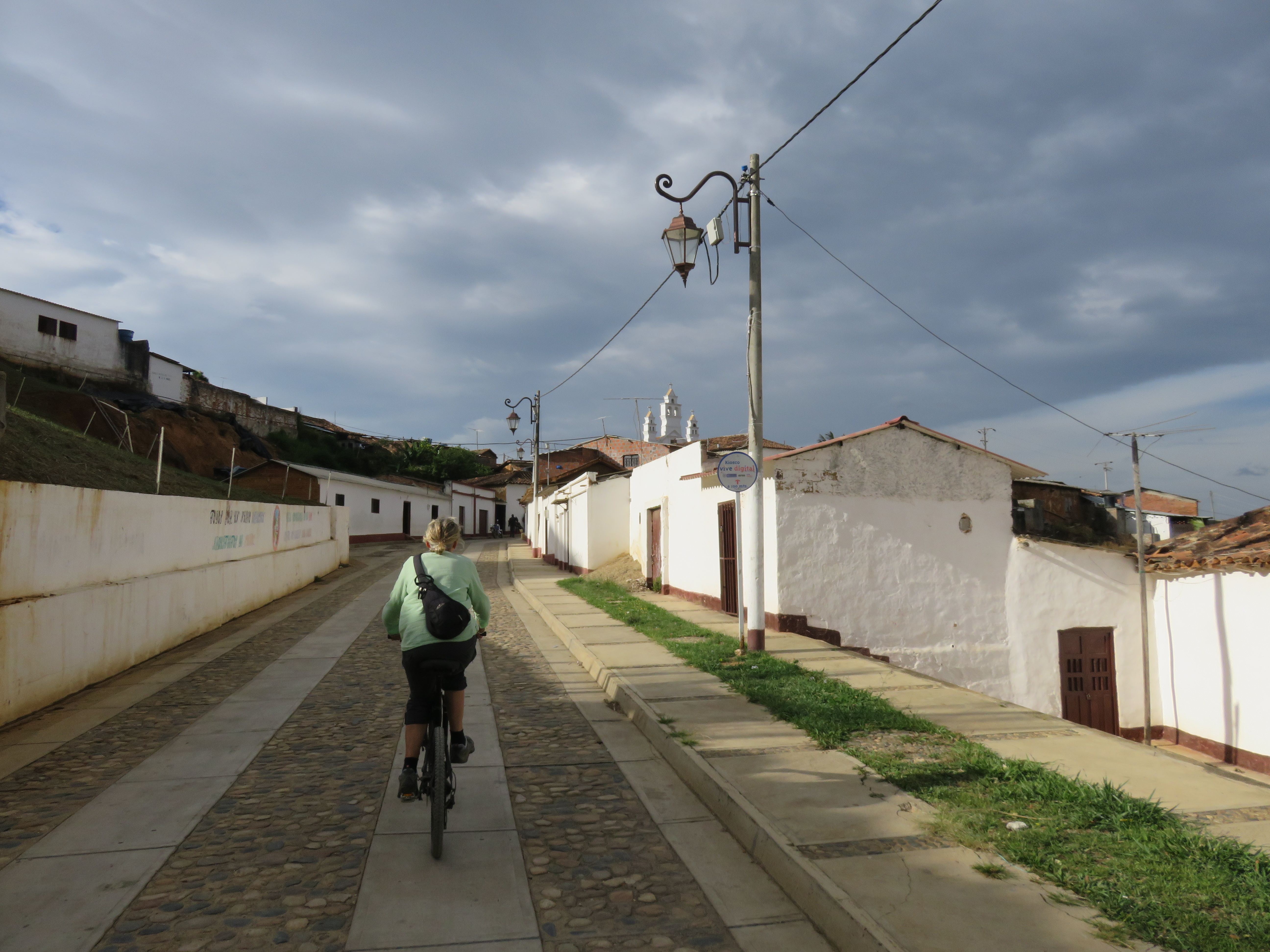
We left the site and drove east on that same dirt road, finally we saw a tiny gas station on a ridge with a great view and pulled in. The young man was very friendly and told us to park wherever we want. It was a great spot, we rode our bicycles around and over to the little colonial town of Aspacica, which is just around the corner and very pretty, they do not get tourists and it was rather unspoiled. Just a little rural town with white washed houses, red tile roofs, a beautiful old church and people going about their business. We had lots of visitors at our camp spot the next day, everybody wanted to see our little house on wheels, they hung around for hours, called their friends and brought us fresh hot arepas.
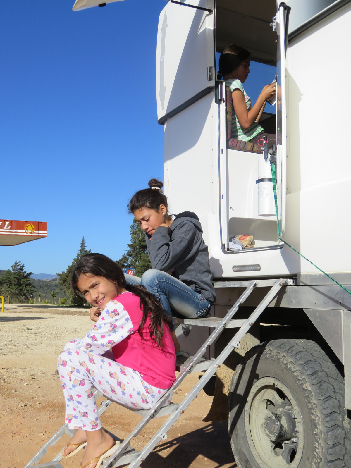
Tatiana and her girl friends, spent the night in the gas station so they could be here in the morning.
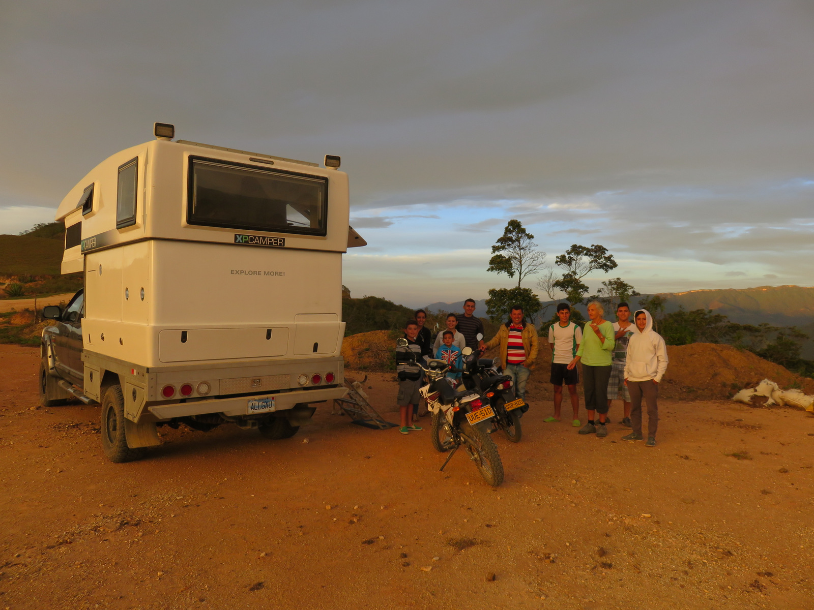
Visitors, brought us arepas.
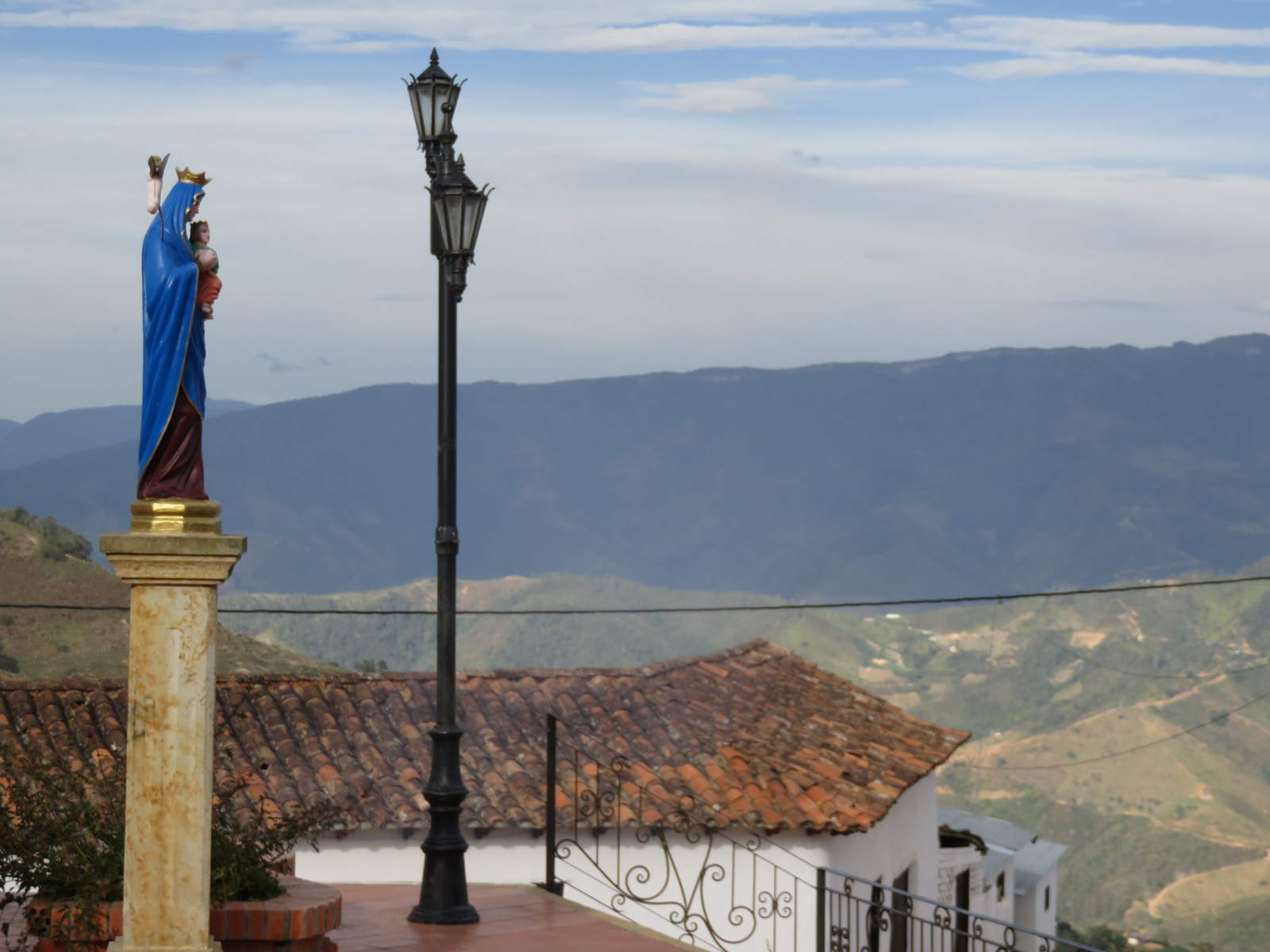
Aspacica
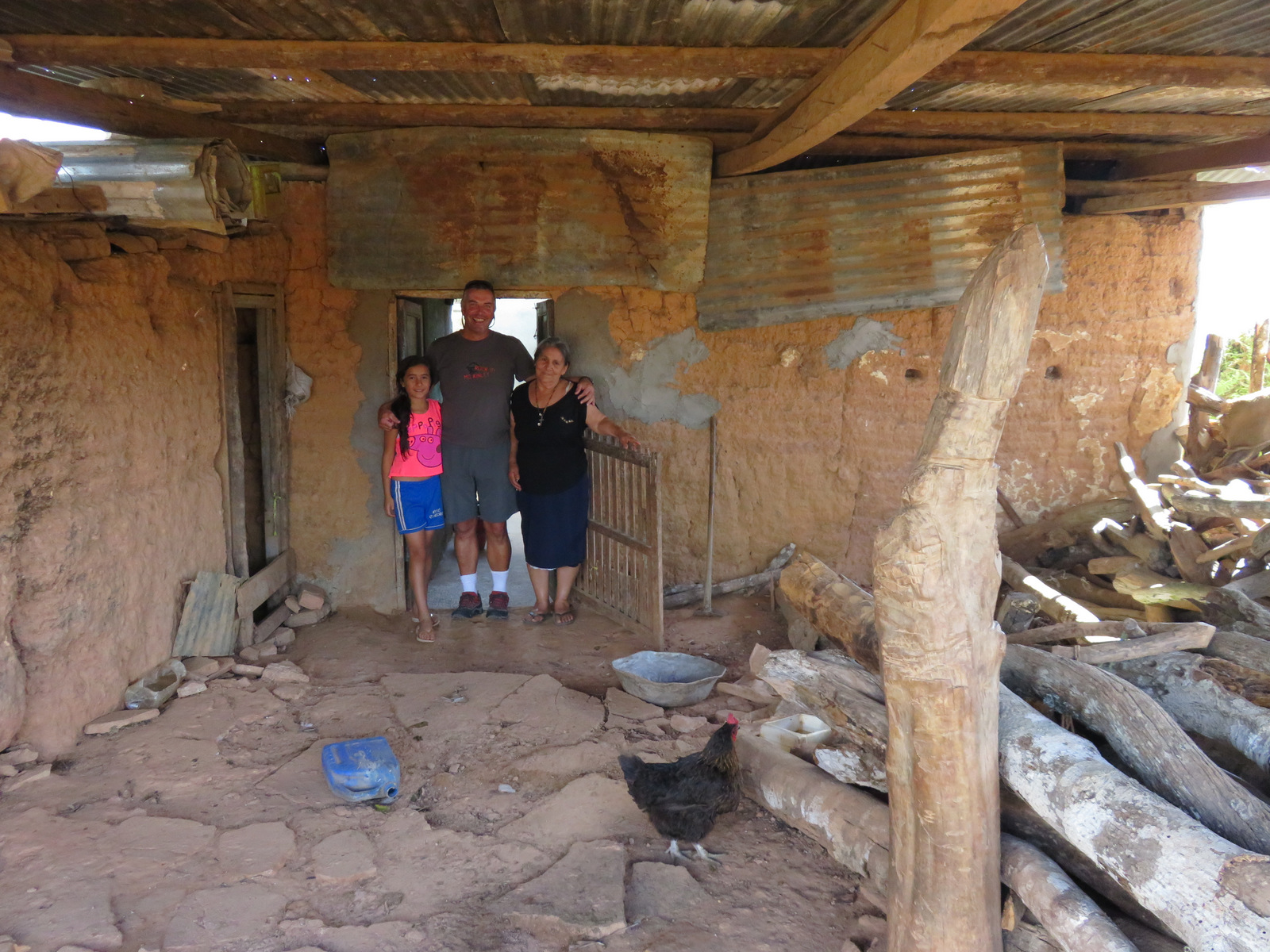
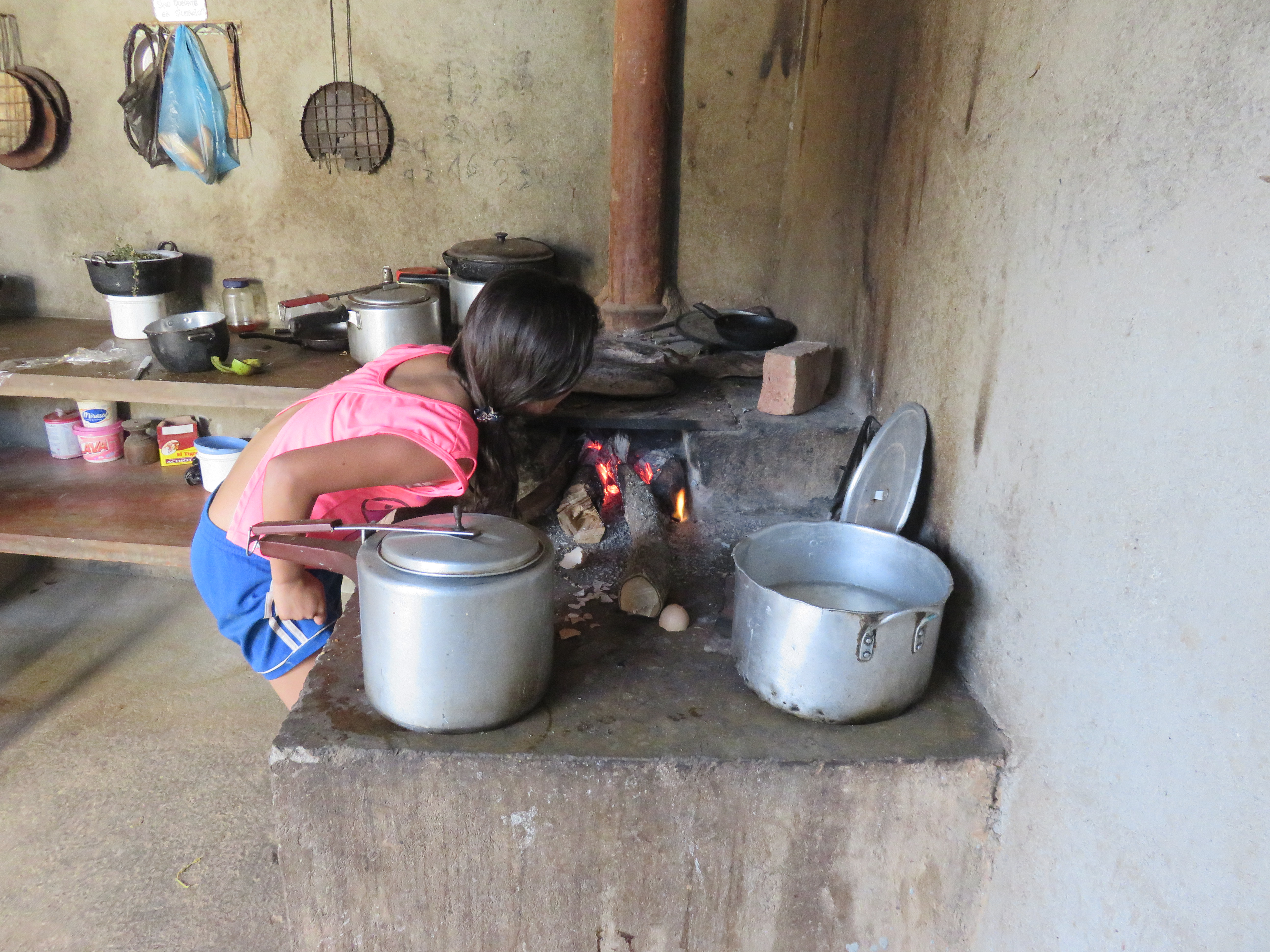
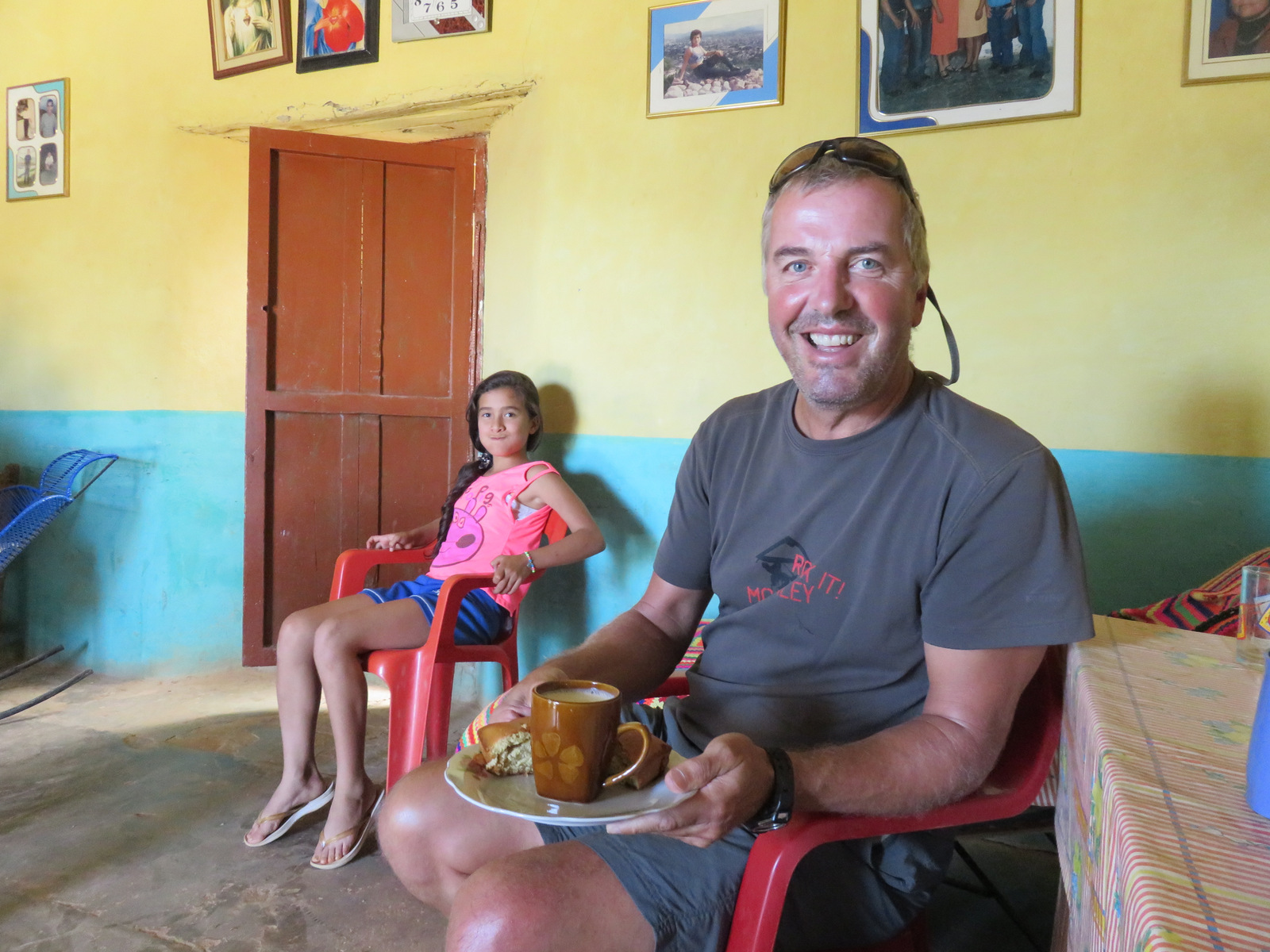
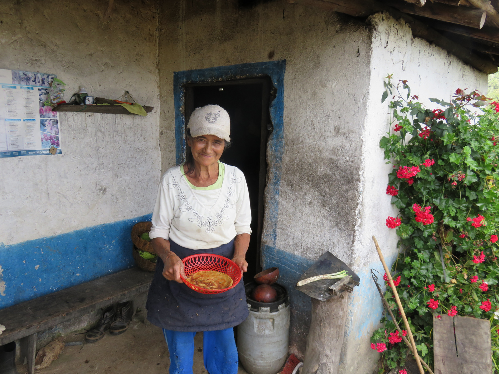
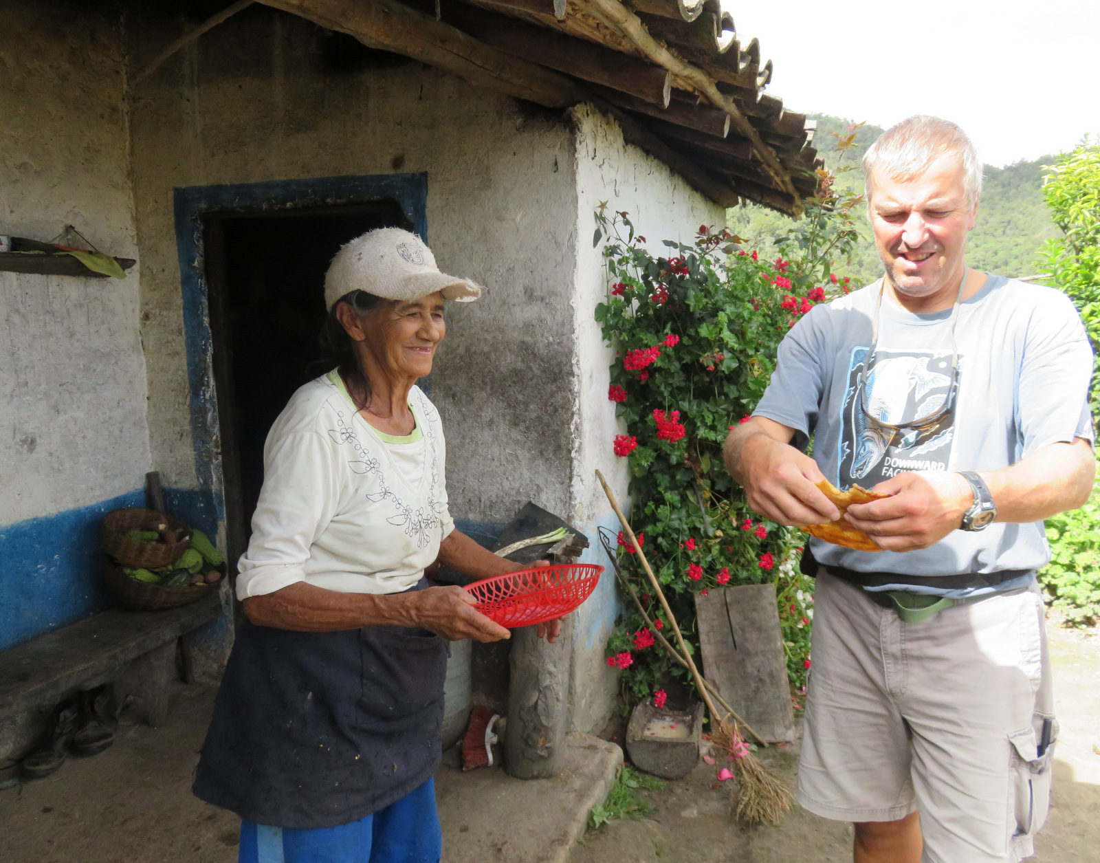
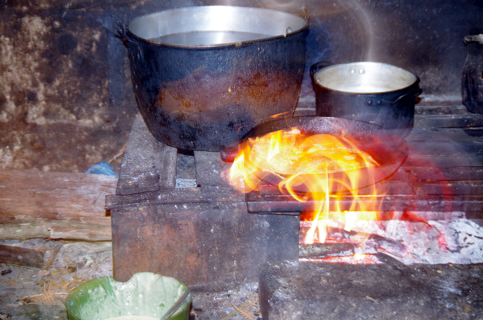
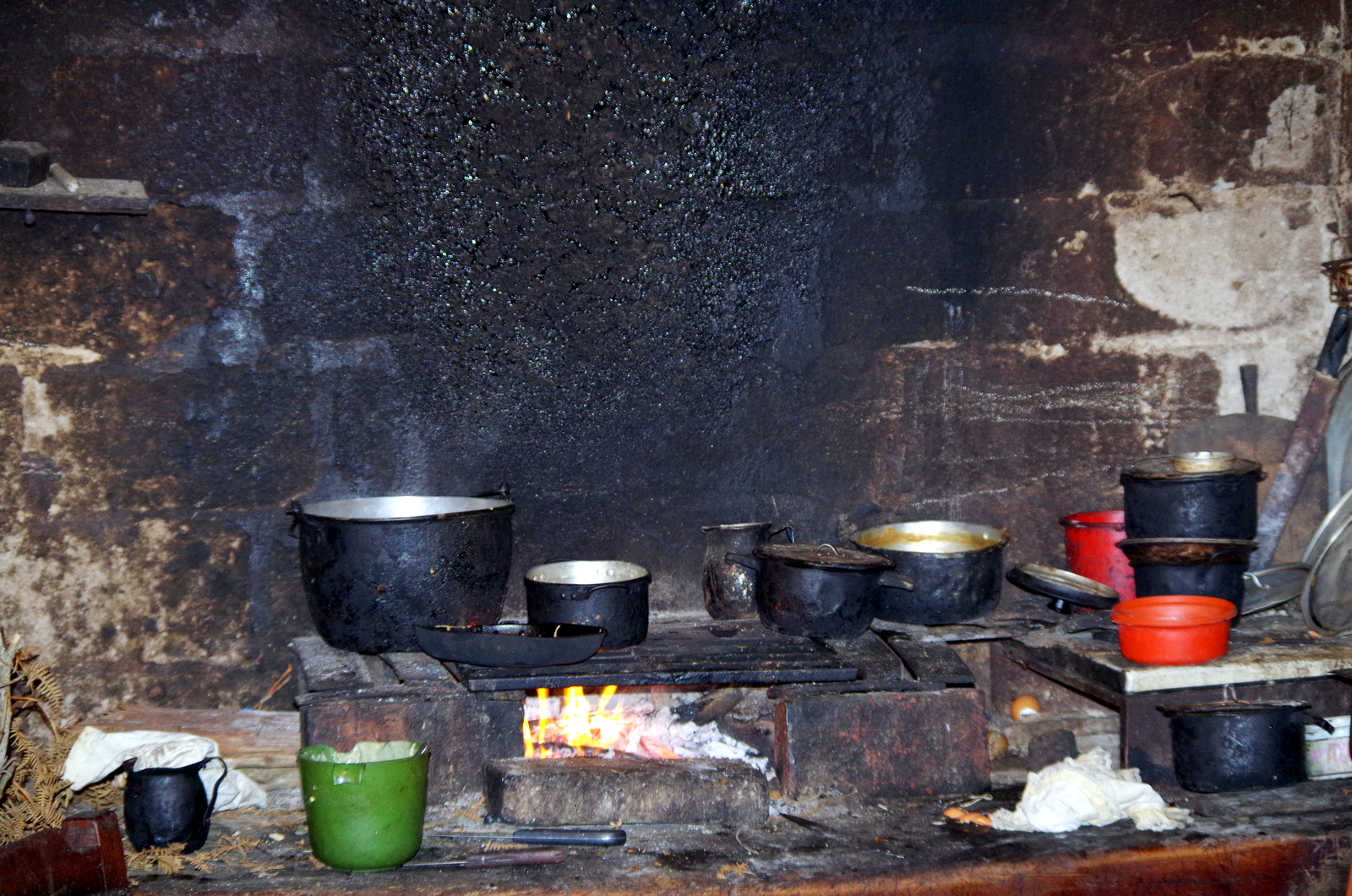
Next to our camper were some cows and soon the farmer came over to talk to us. He, Clemente, is 75 years old and was very nice, he invited us over to his house and in the afternoon we walked over. The houses usually are made of mud bricks and are white washed, simple furnishings, open fire for cooking in the attached kitchen, pictures of family members, dead an alive, are on the walls. His wife served us hot sweetened milk fresh from the cow and some kind of sweet bread. This is the second time we have been invited into people’s homes and it is always very special, I prefer this kind of experience to any tour the guide books recommend. From now on, we are going to try to do this more often. I had two little hand painted pitchers in my stash of souvenirs, bought them in Mexico somewhere, as a present we brought them to Clemente and his wife Chaya. One should not come to a home empty-handed since they will always break out some specialty and try to feed you. We promises of a return some day we left them and drove on.
Aspacica
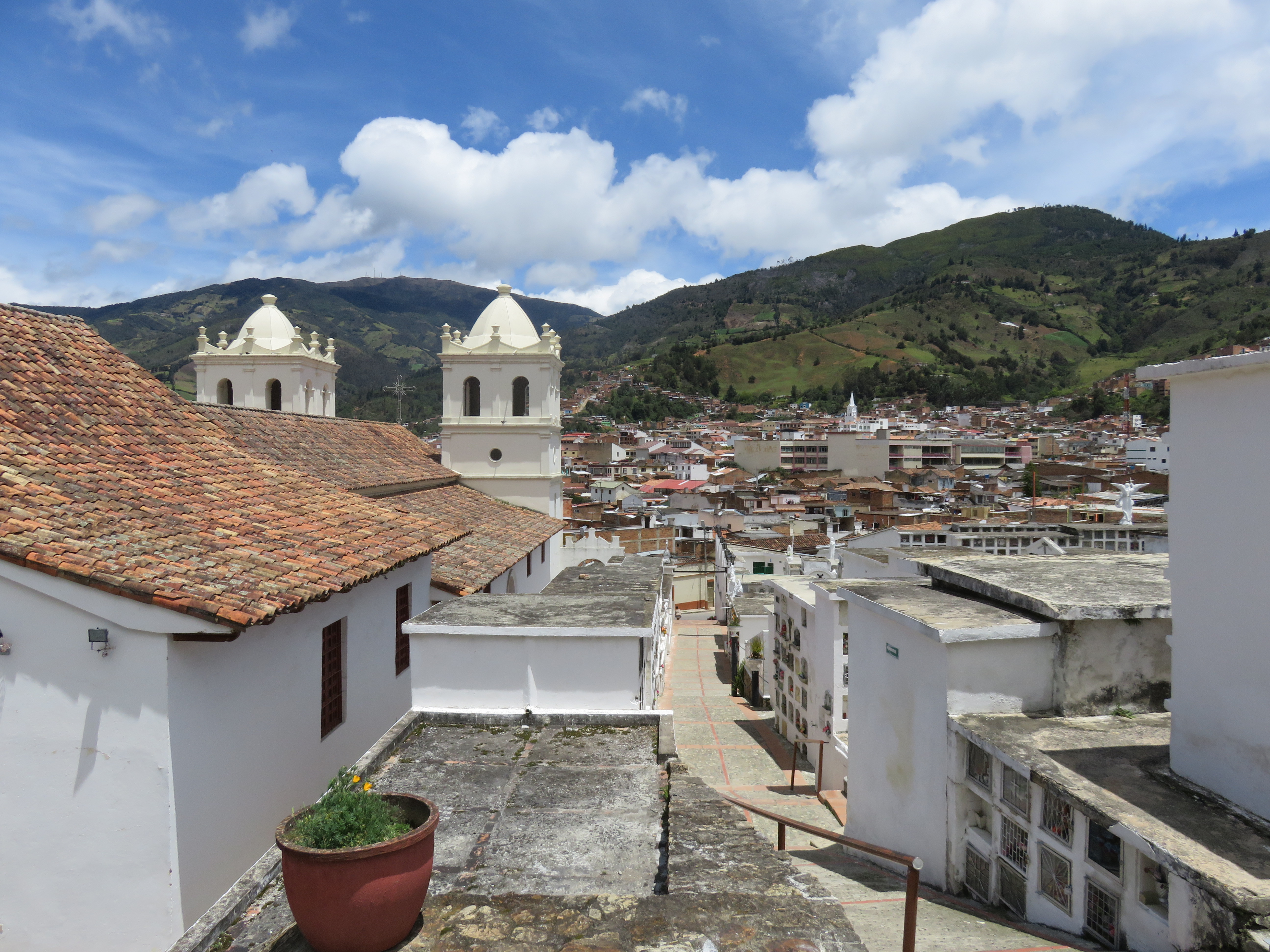
Pamplona
A colonial university town, it is set in a lush green valley at 2300 meters, we parked for free on a dead-end dirt road above the bus terminal, the center of town was just a short walk away and we spent a lot of time wandering around, shopped at the market, went to church and went to the little museum of their famous home town boy, Eduardo Ramirez, his art is very modern and I am not sure if I liked the art more or the building that houses the pieces.
Pamplona
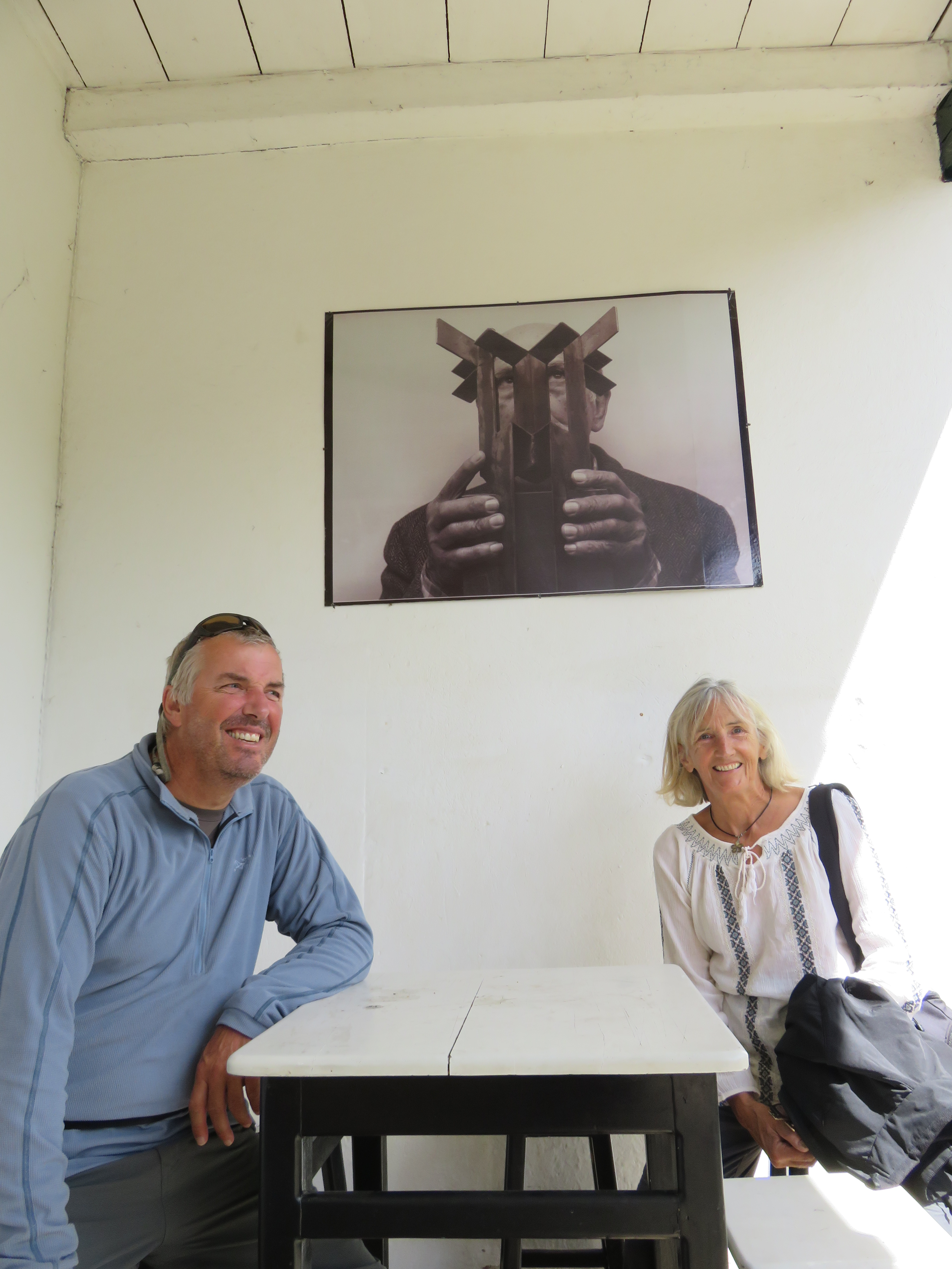
(Museo de Arte Moderno ) Eduardo Ramirez Villamizar behind us.
After a few days we were debating where to go next, head east to Medellin or go south. We started reading our guide books and then did the guide-book tour, watched paragliding in Bucaramanga, looked down onto the Canyon of Chicamocha, drank a “tinto” in Barichara and walked El Camino Real to Guane. Somewhere along the way we had driven over a long screw and it was stuck in the tire, so in San Gil we pulled into a tire shop and 15 minutes later we had the screw removed and the hole plugged, great. San Gil has a fancy mall where we found German and Swiss chocolate, almond milk for our müsle and other hard to find items. This town is geared toward adventure tourism and offers many things for that travellers looking for a thrill in nature.
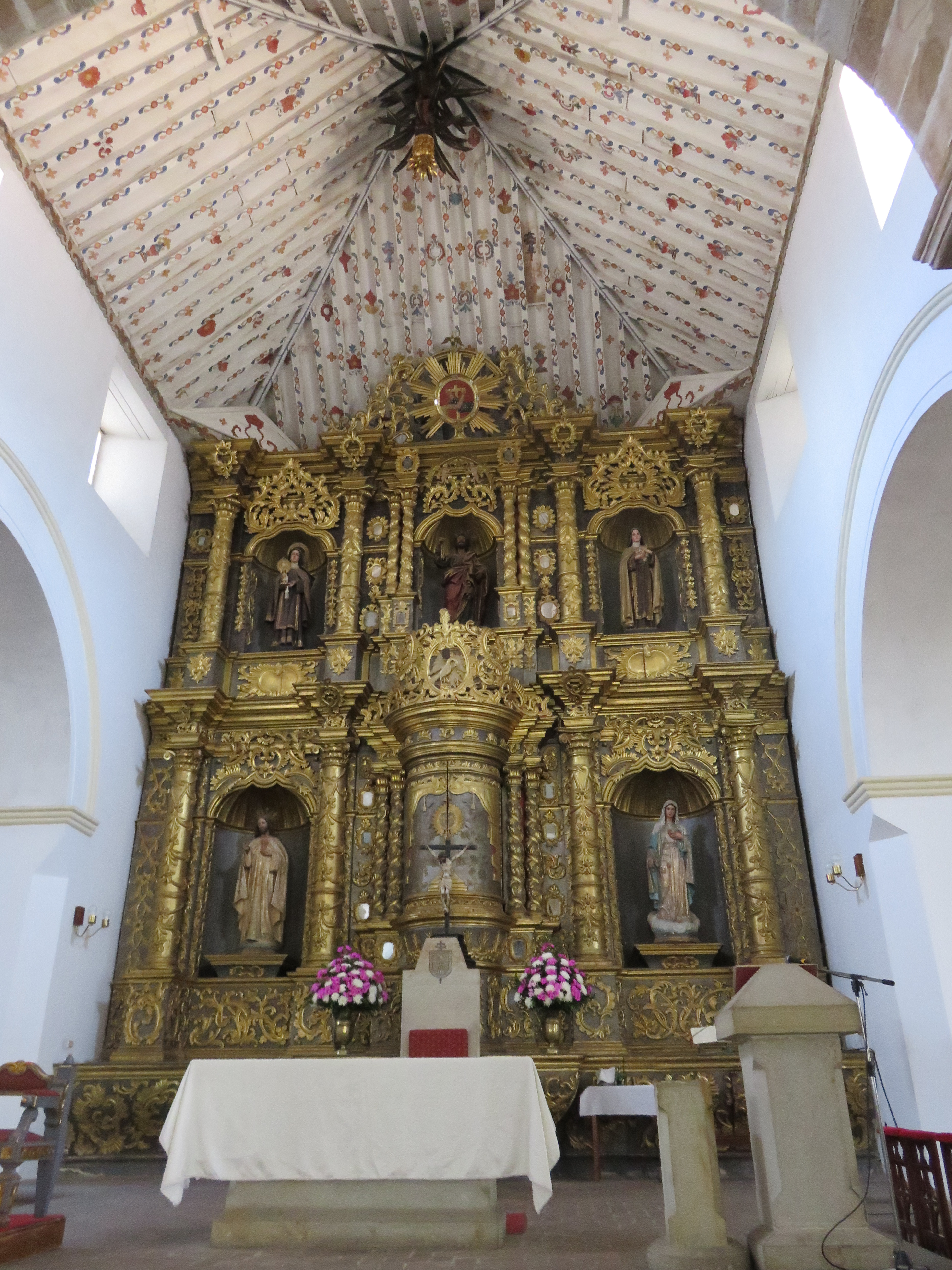
Guane, baroque altar, I loved the painted ceiling.
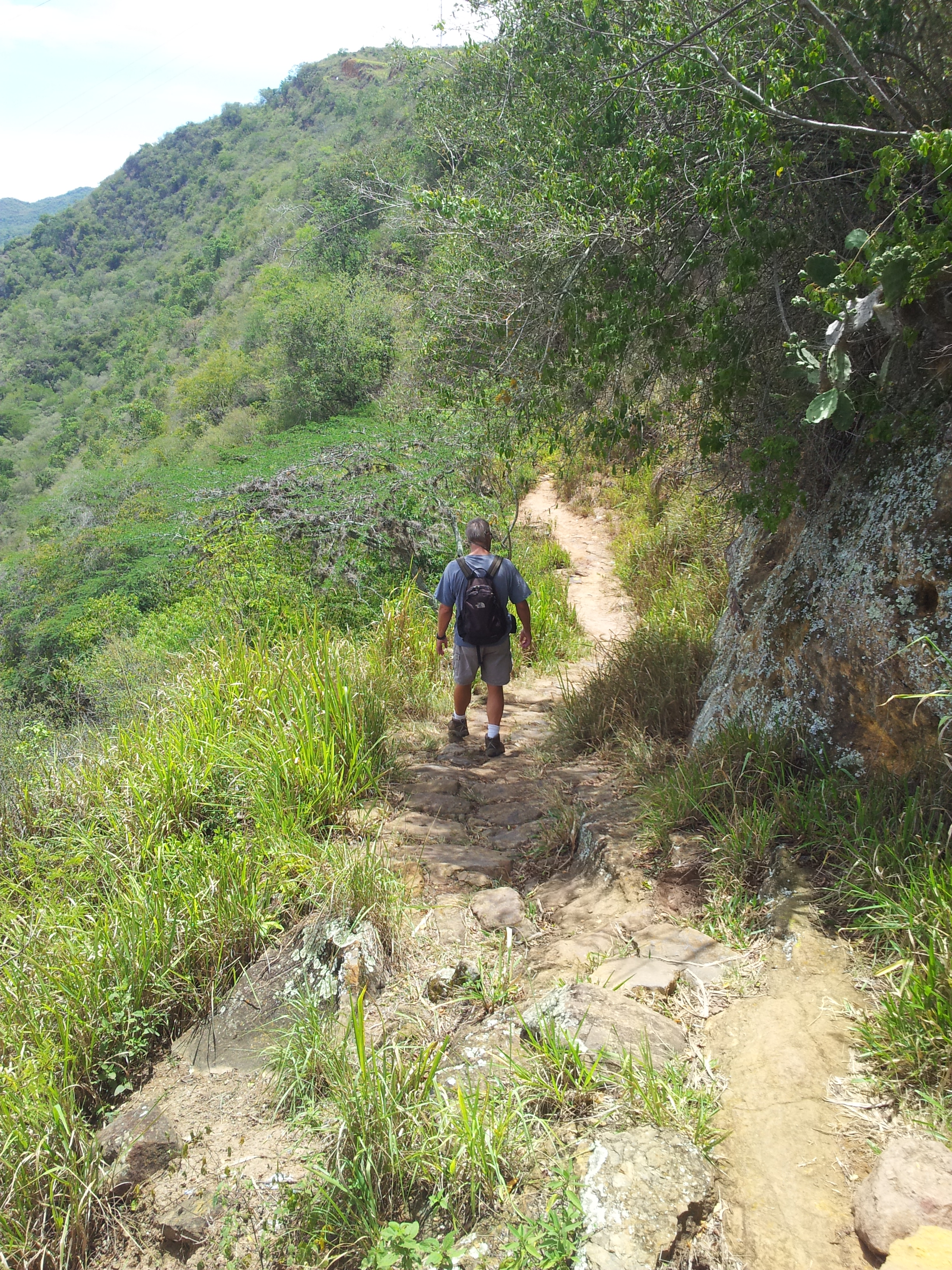
Camino Real hiker
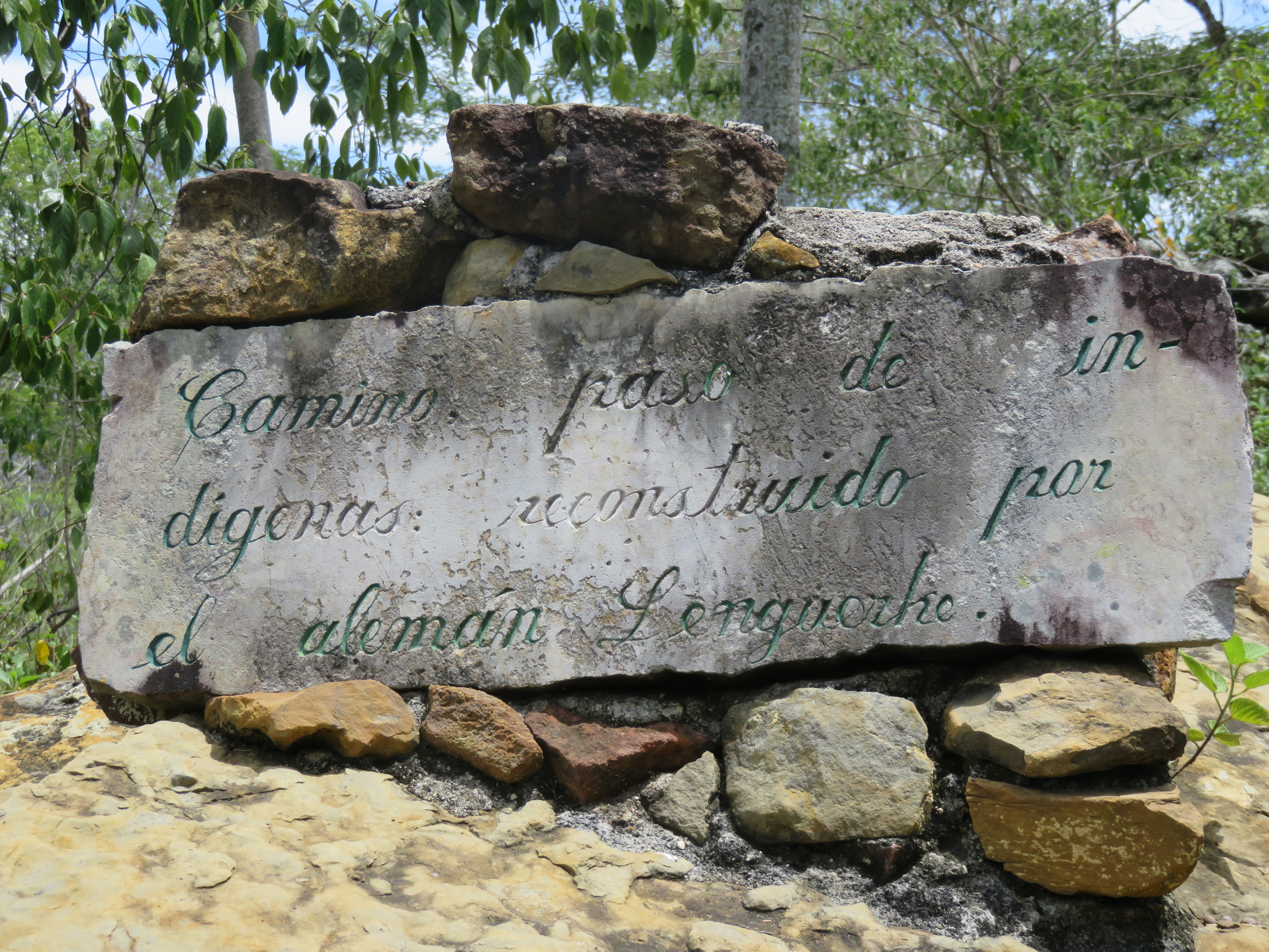
Camino Real trail was rebuilt by a German over 100 years ago.
If you are drawn to adventure walks and like to follow in the shadow of 19th century explorers, then the story of German colonist Geo von Lengerke will get you motivated for a trip to Guane. Lengerke ambitiously set out to unite the highlands of Santander with the Magdalena retracing the original indigenous footpaths. Over six hundred kilometers of stone tracks once used for mules have survived and you can meander your way on these rocky trails through fruit orchards and tobacco fields .
A quote from the Bogota paper:
Heavy iron beams engraved with ‘Bremen 1867’ are now gates to private homes, and there is a particular look to the inhabitants of the Guananta region. Many are tall and fire-skinned, and when they flash a smile, their blue eyes light up. During his years in Santander, Lengerke miraculously found time to populate (thanks to his many girlfriends) the department. Wander with free roaming goats through a patchwork of narrow alleys and visit the town’s unique paleontological museum with its wall-to-wall collection of fossils. The beautiful historic stone church remains almost the same today as the day it was built four centuries ago. –
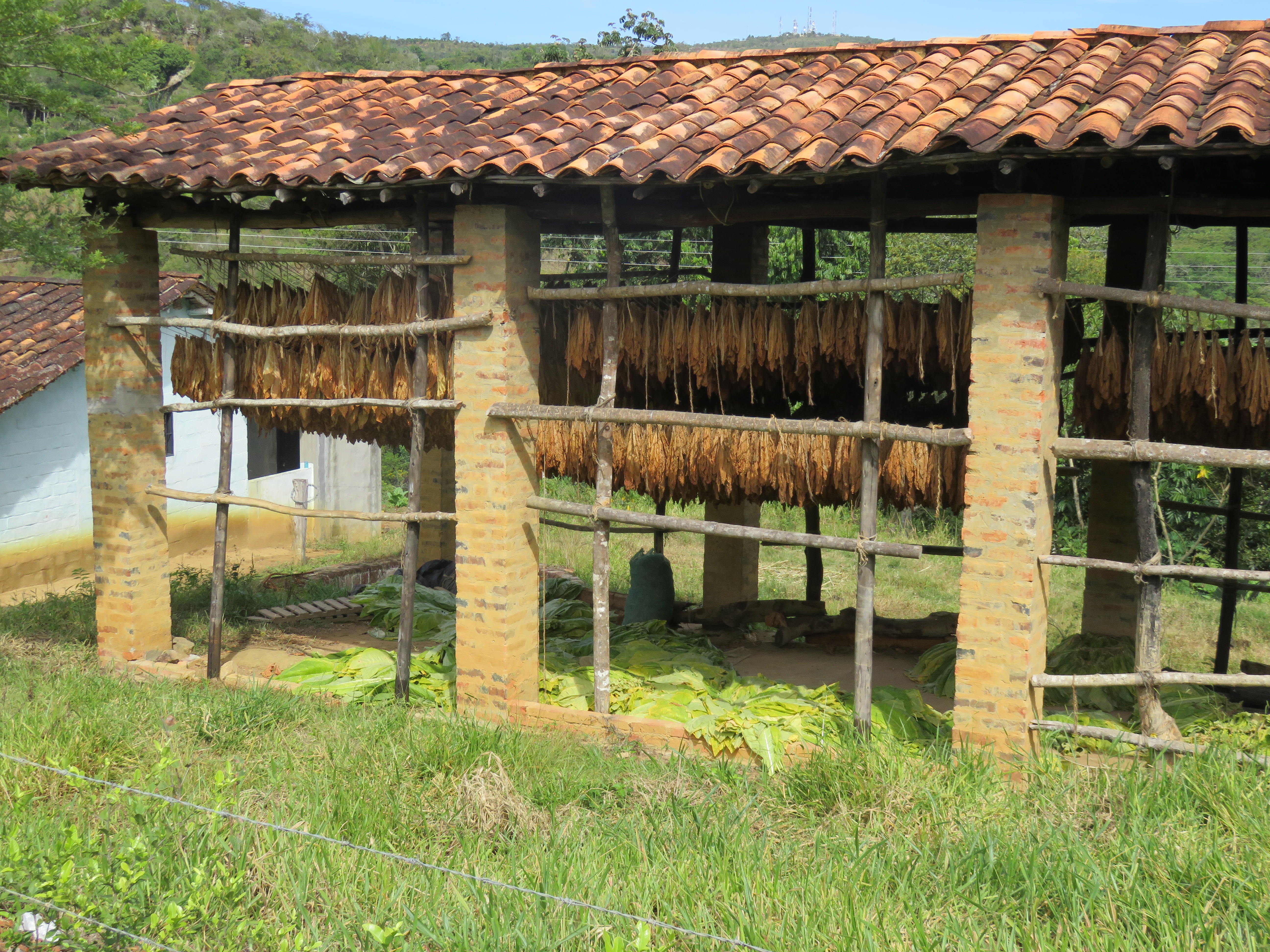
Tobacco
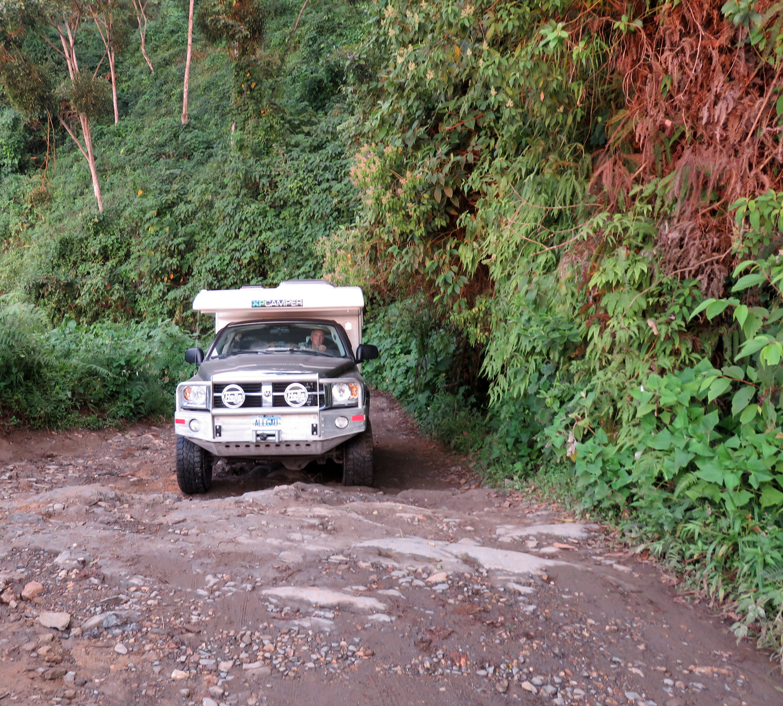
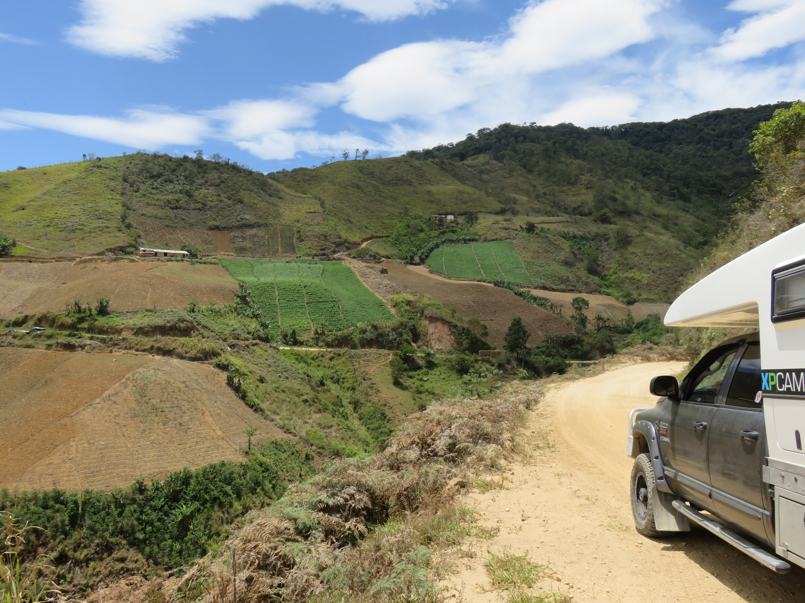
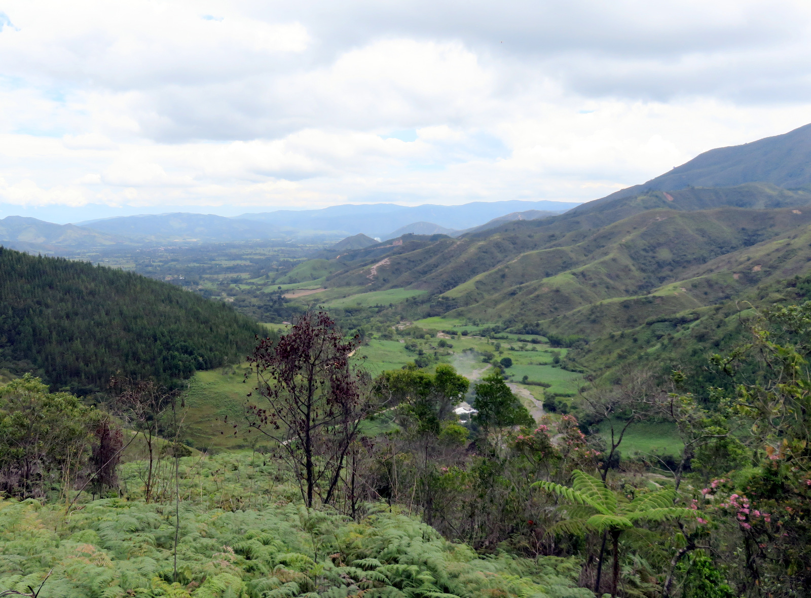
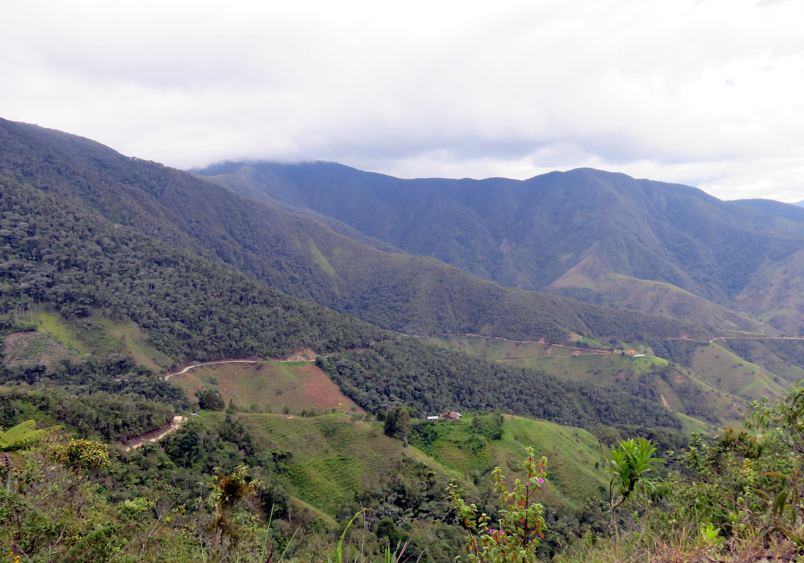
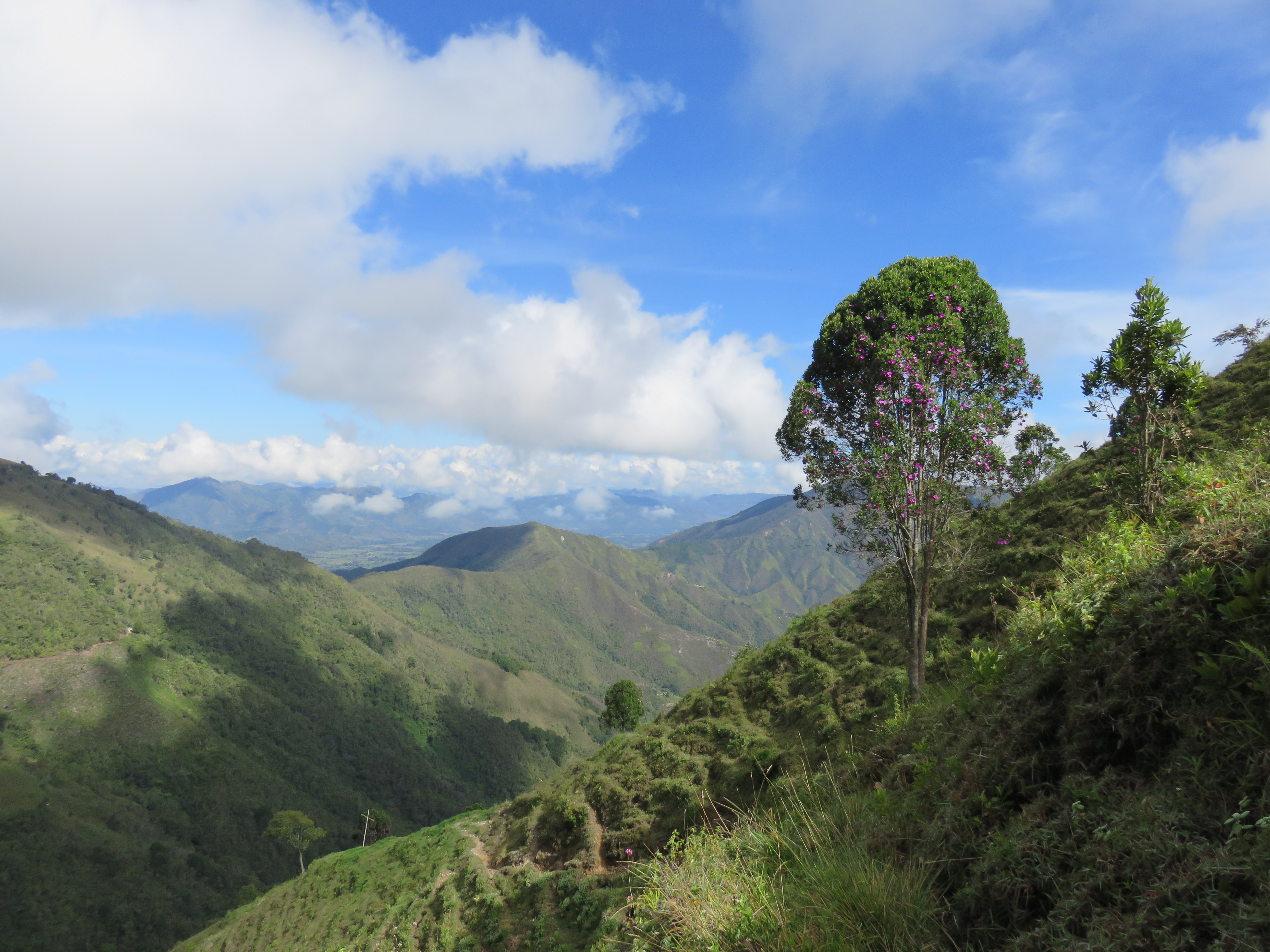
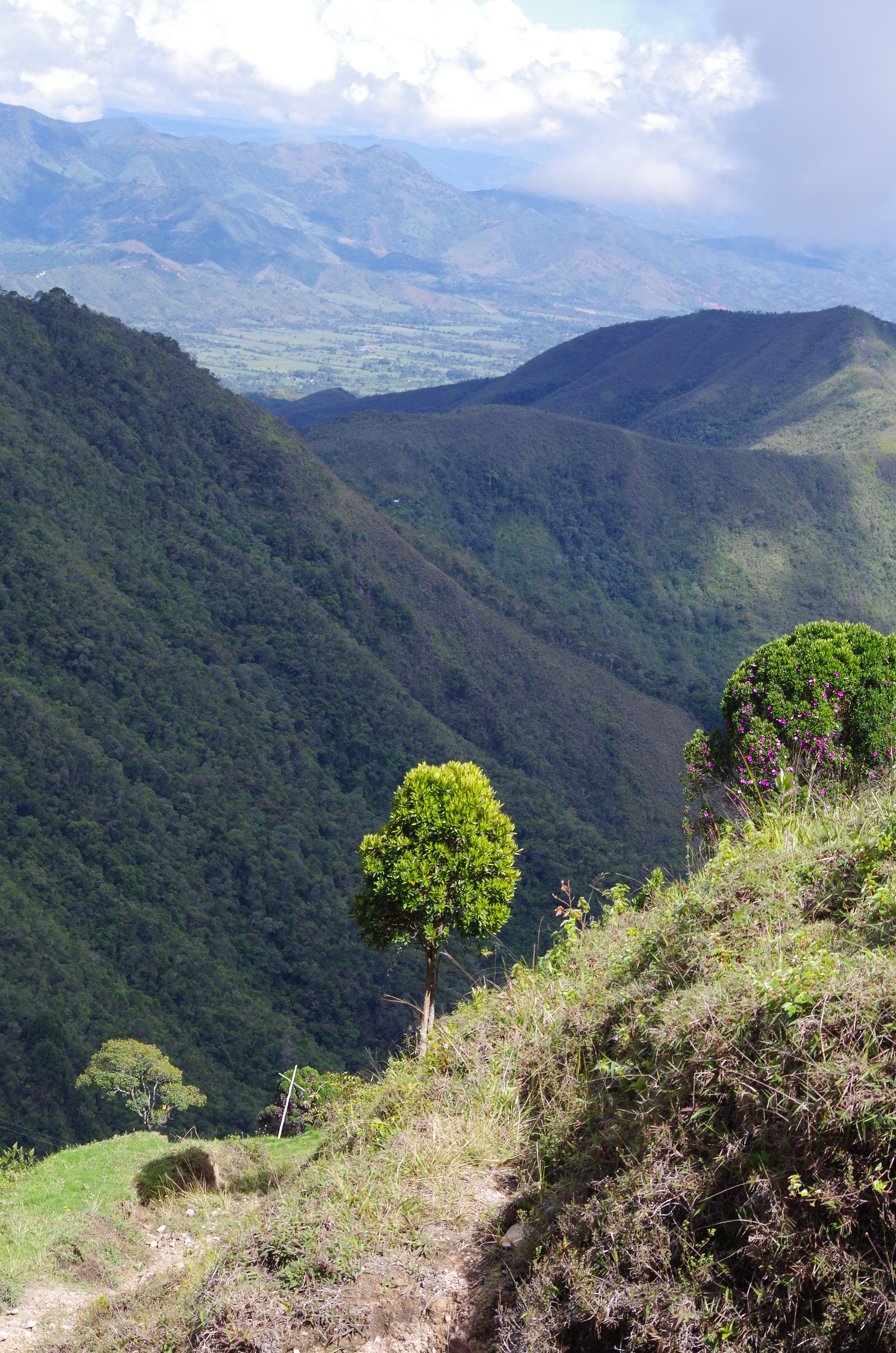
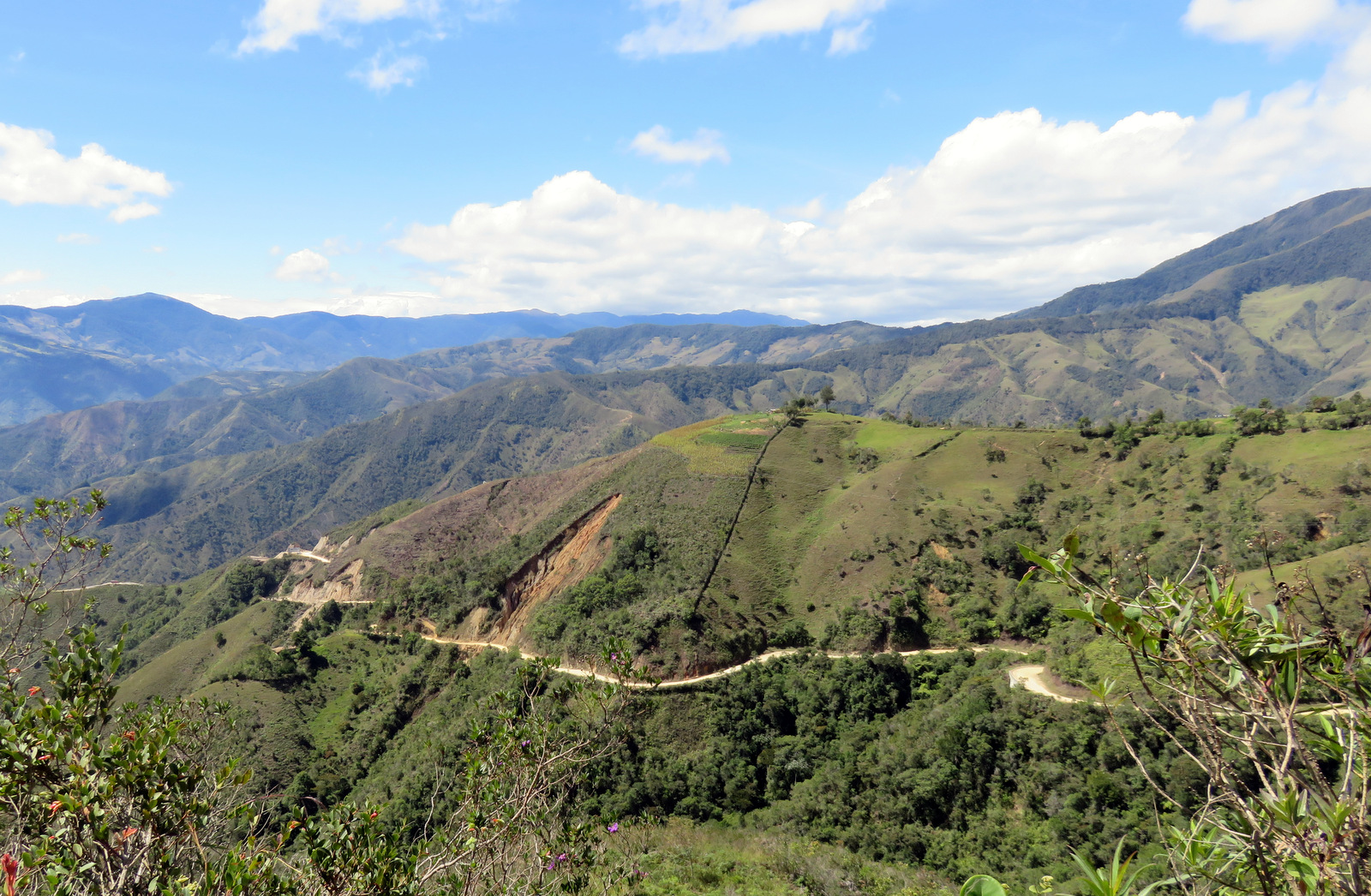
The Sierra Nevada del Cocuy mountains were next on our list, the highest mountains on the eastern range, so we had to go east again. There is a small road from San Gil to Mogotes and then on to Soata. An absolutely beautiful drive through hills and small farms, along canyons and through little towns. It is a long drive and one should plan at least two days for it because you want to stop and look. The road looks daunting sometimes but trucks and medium size buses drive it every day.
Mogote in the distance
The road up to the pass.
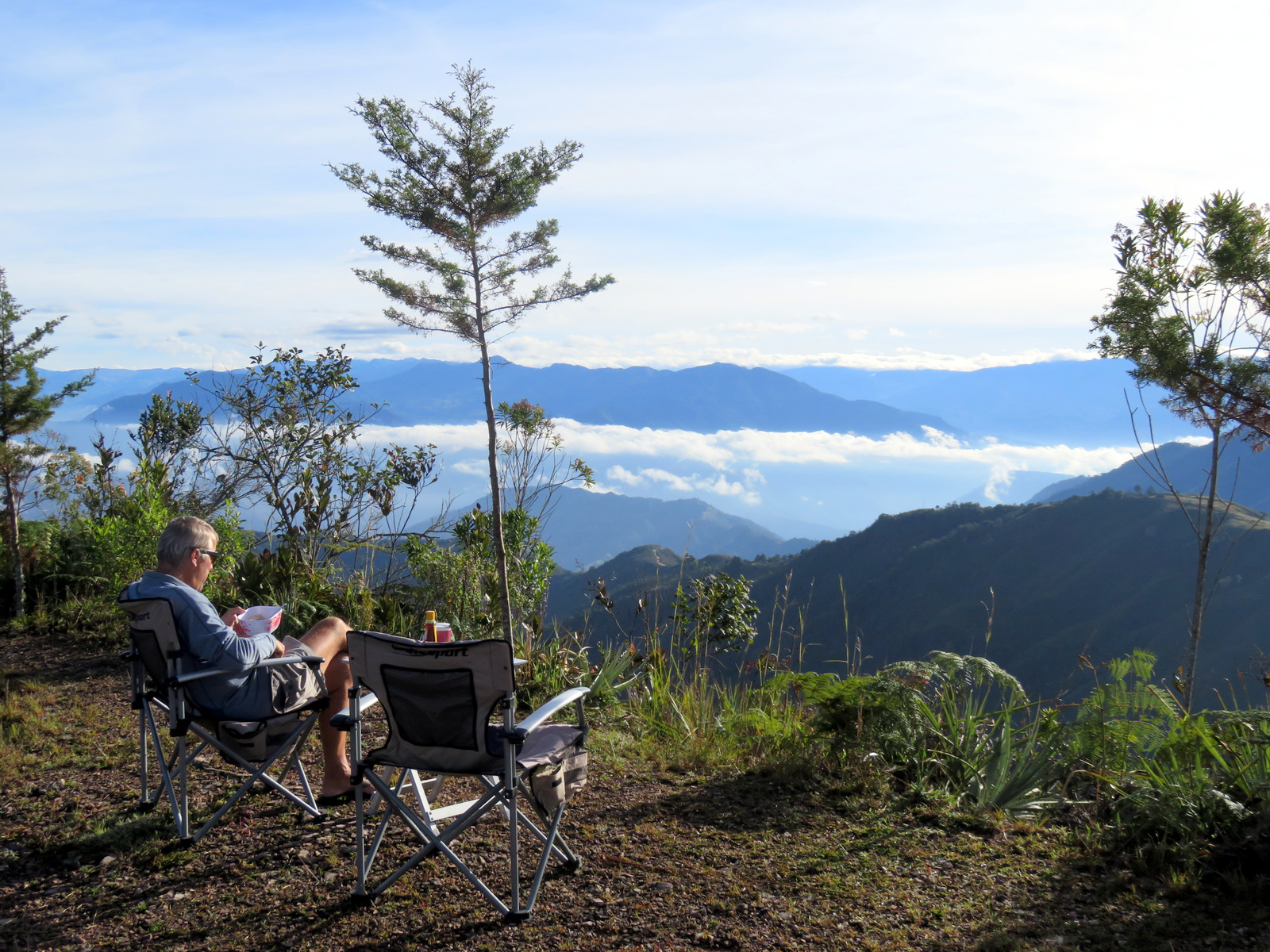
Our camp spot on top.
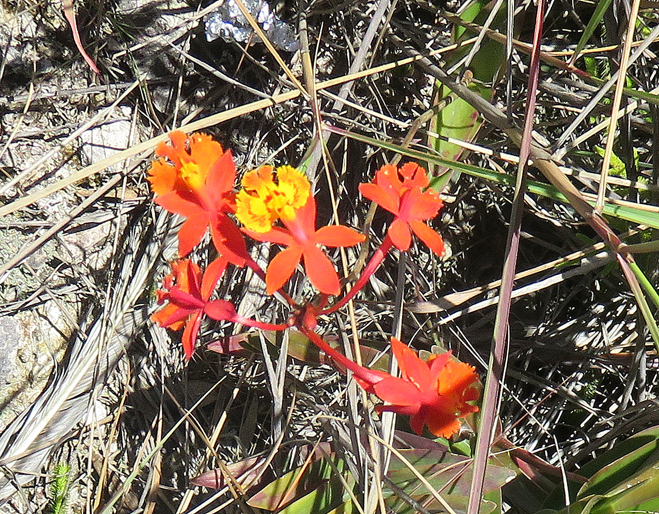
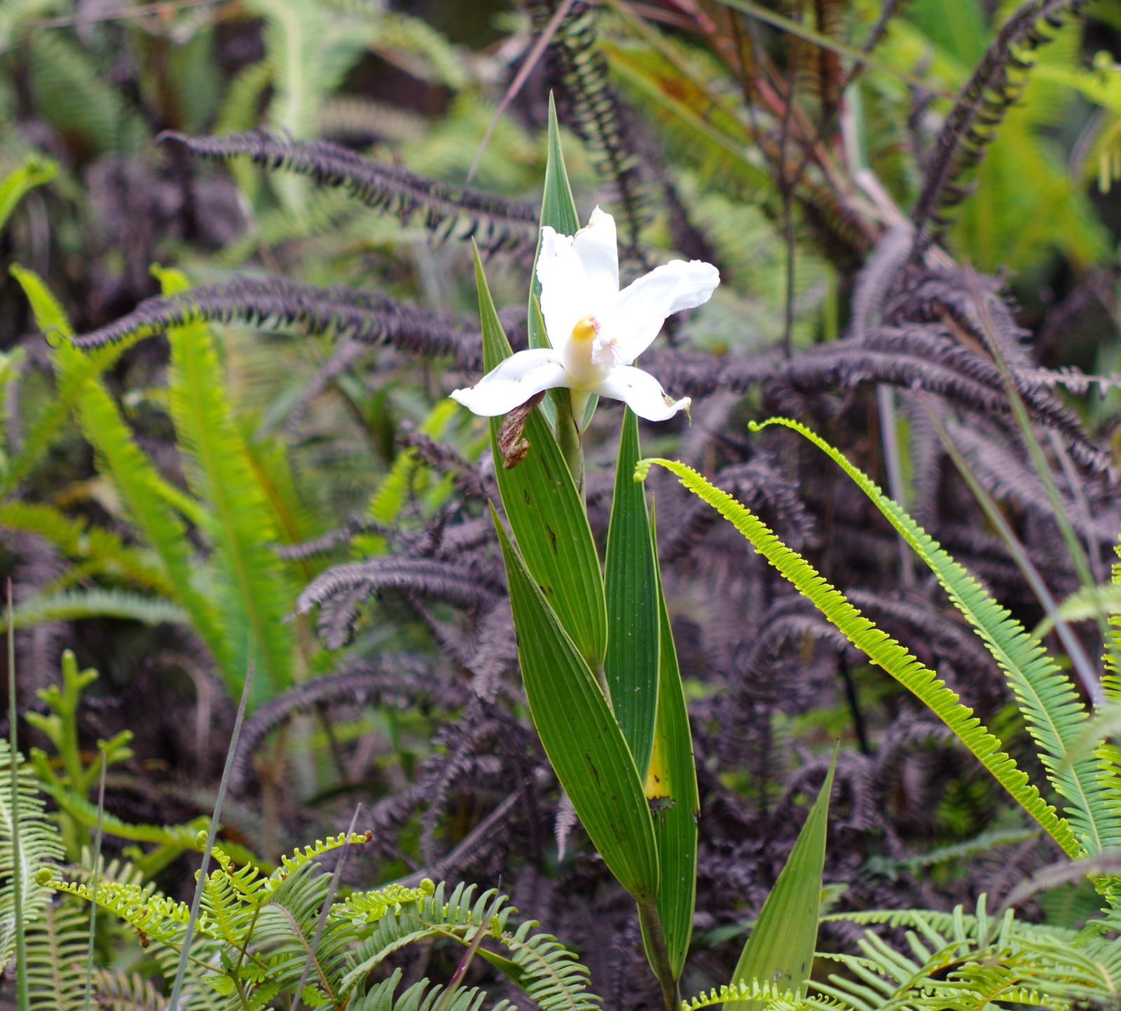
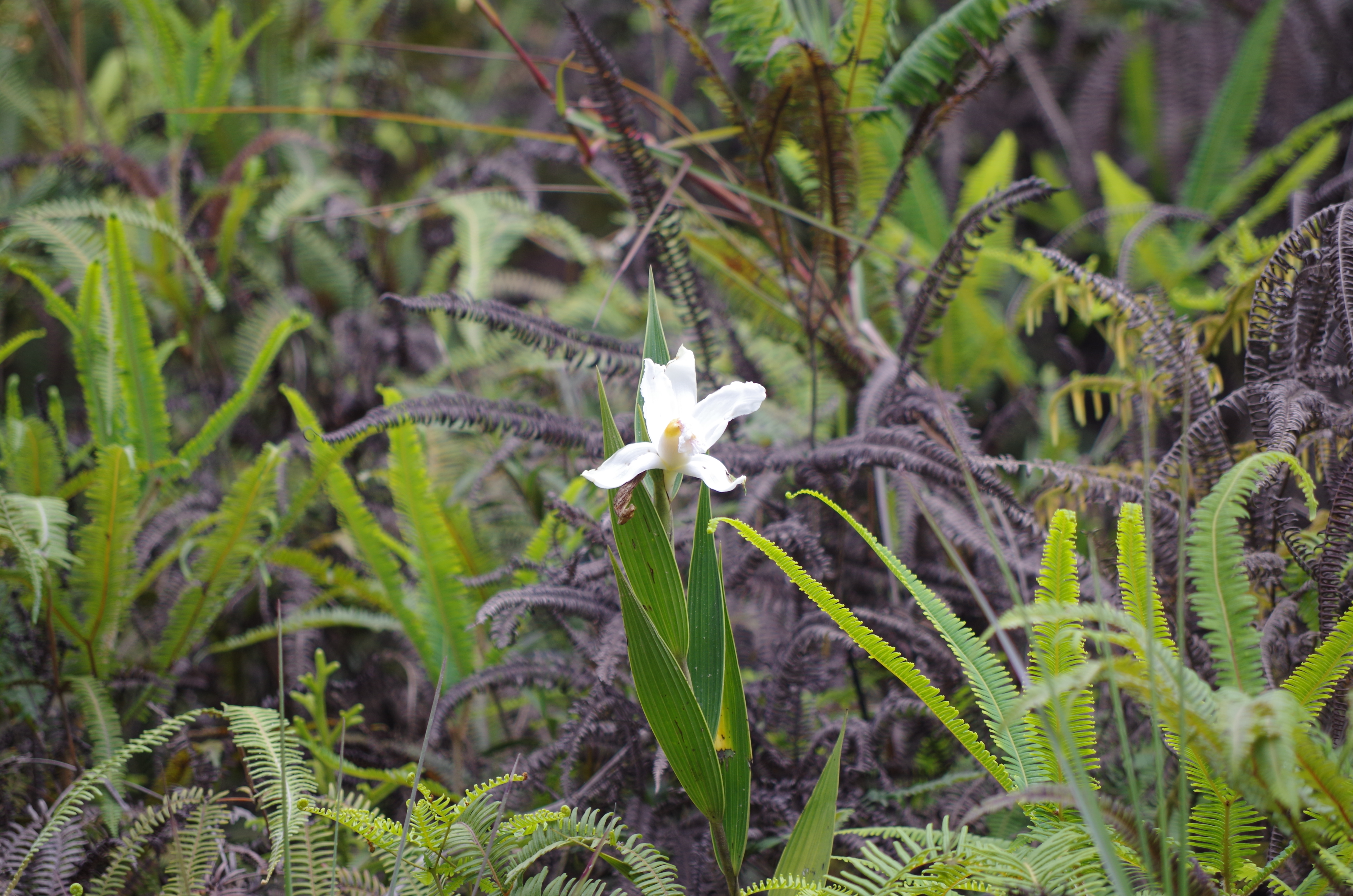
On top of the pass ( 2577 m) between Mogotes and San Joaquin we stopped early in the afternoon, the views were spectacular and the parking area large. We decided to stay and spend the night. I took the walking stick and followed one of the trails, there are little farms on the steep hillsides and they can only be reached on foot or hoof. What really amazed me were the many different orchids growing trail side, large and small, white, pink and red.
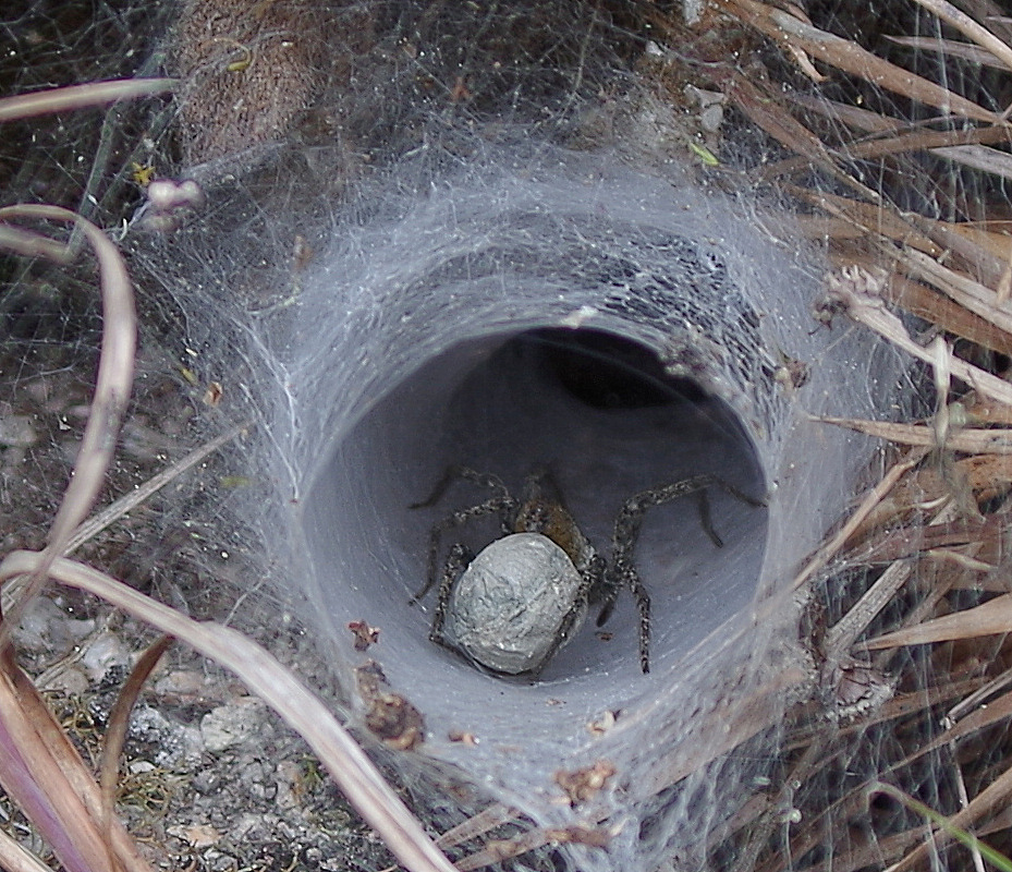
Crazy spider web.
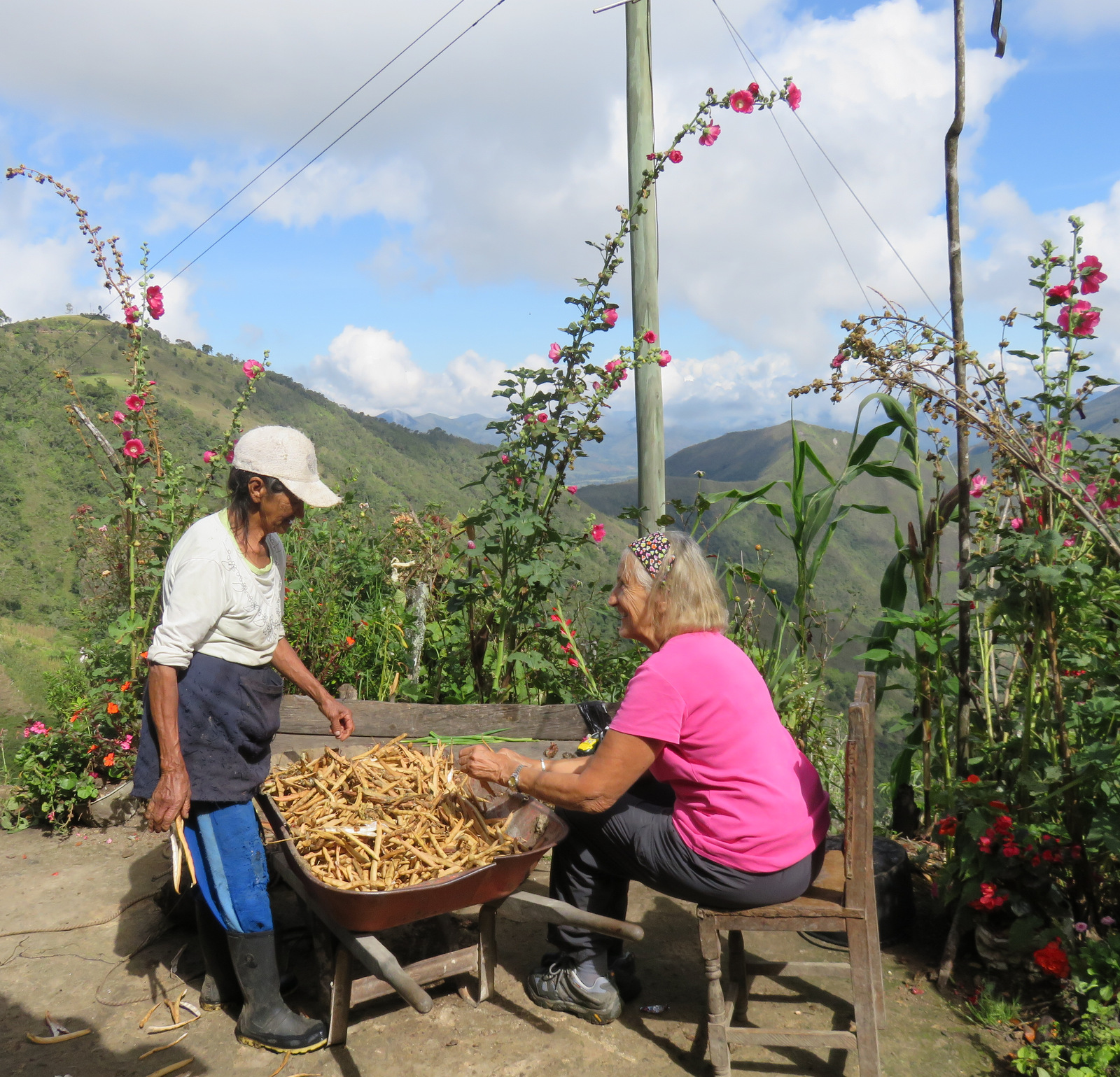
While I was hiking I saw an older (one year older than me 🙂 )woman carry up a heavy load so I waited for her, she had a strap on her forehead and on her back was a milk bucket. She was waiting for the milk truck. I sat down beside her started to ask her some questions, it it easiest to start a conversation by asking about children and grand children, they are their pride and joy. Her name was Marina and she has two cows, a donkey, chickens, cats and dogs and yes, she invited us to come down to her farm. So the next morning I took off by myself, mandarins, cookies and a chocolate cake in my pack, with trekking poles, because the trail is very steep and at times serves as a creek I think. After 1/2 hour I got to the house and was greeted by her grand-daughter Carolina that lives with her. Marina showed up with a huge root she had dug up in the woods with her machete. From what I can gather it is a special root and she chips and dries it and sells it. She tried to give me milk (not again) and then started removing beans from pods in a wheel barrow, so I helped her for a while but then she decided to cook me a sweet arepa, by now Günter had showed up and we enjoyed the treat and hot “tinto” from her own coffee beans. Her garden was overflowing with vegetables, fruit and flowers. They live self-sufficiently and rarely leave home. Every day, she milks the cows and carries the 8 to 10 liters up the steep trail to the top where we had met her. There, at 4:15 pm a truck comes and collects her milk. No wonder she is in such great shape, when we said good-bye and headed back up to our camper I looked down and I saw a tiny figure running swiftly along a steep trail towards the cows, it was Marina.
The trail down.

Sweet arepa.
Shucking red beans.
Hiking back up from Marinas granja.
The road down the other side to San Joaquin.
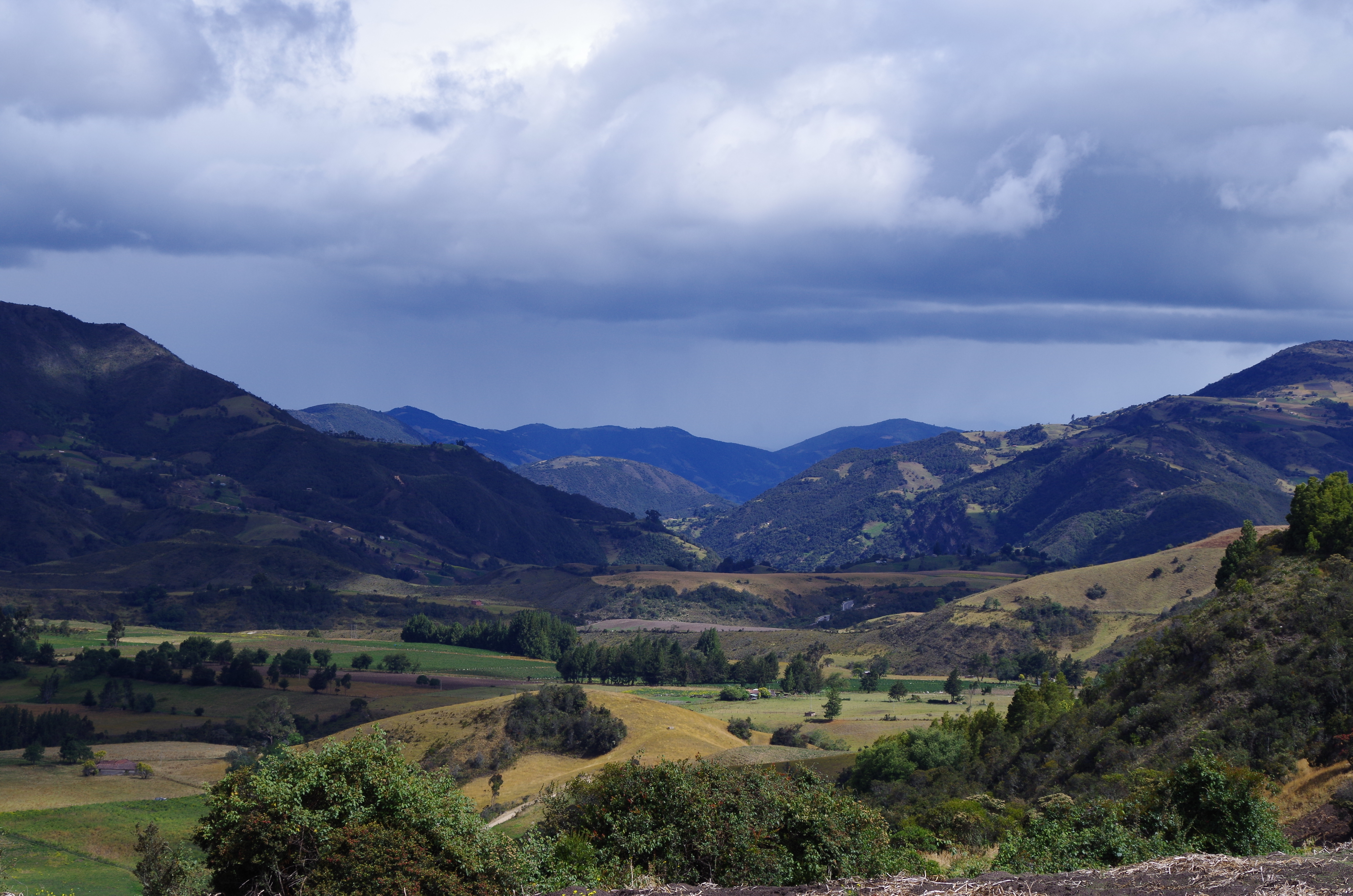
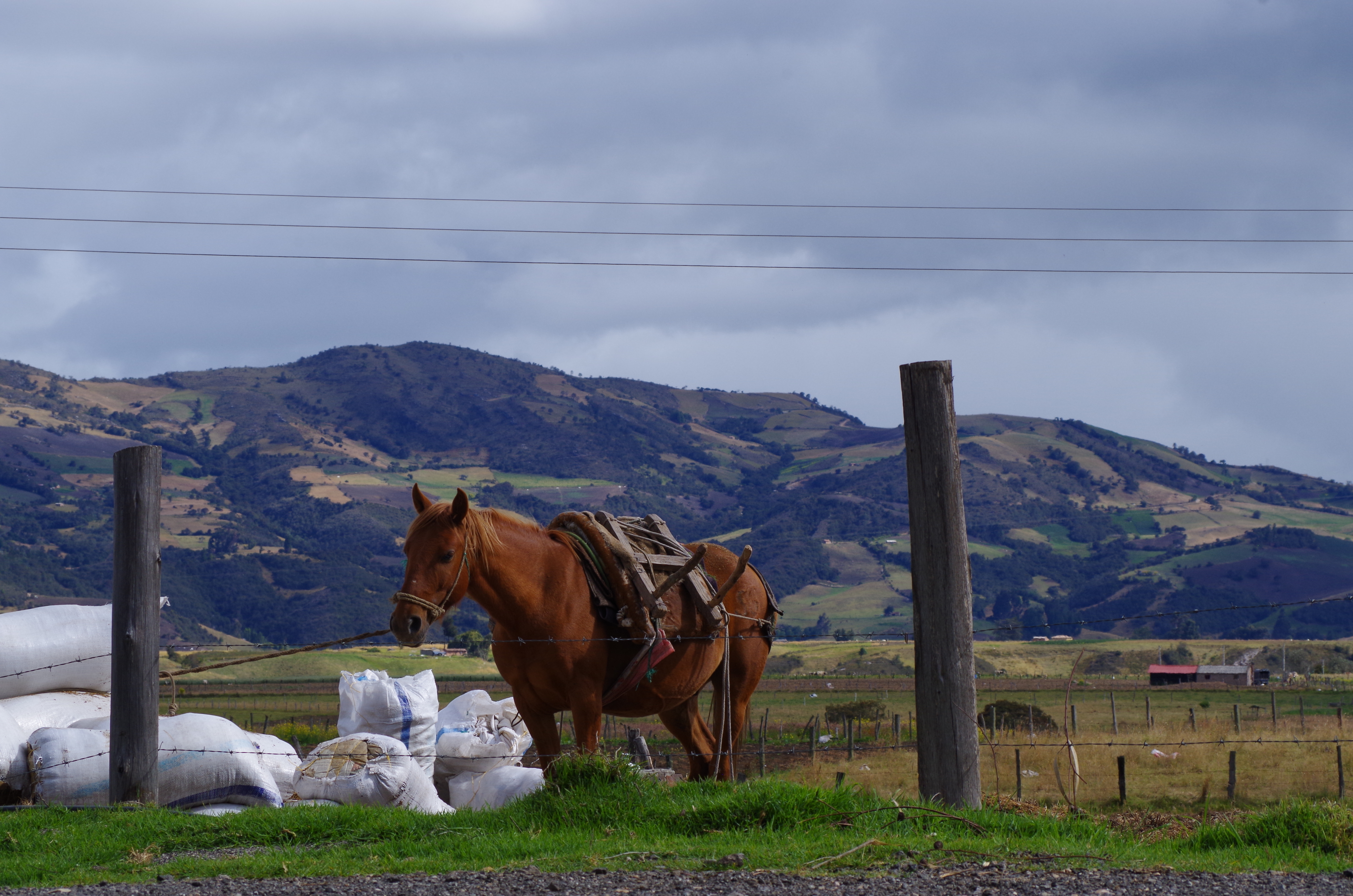
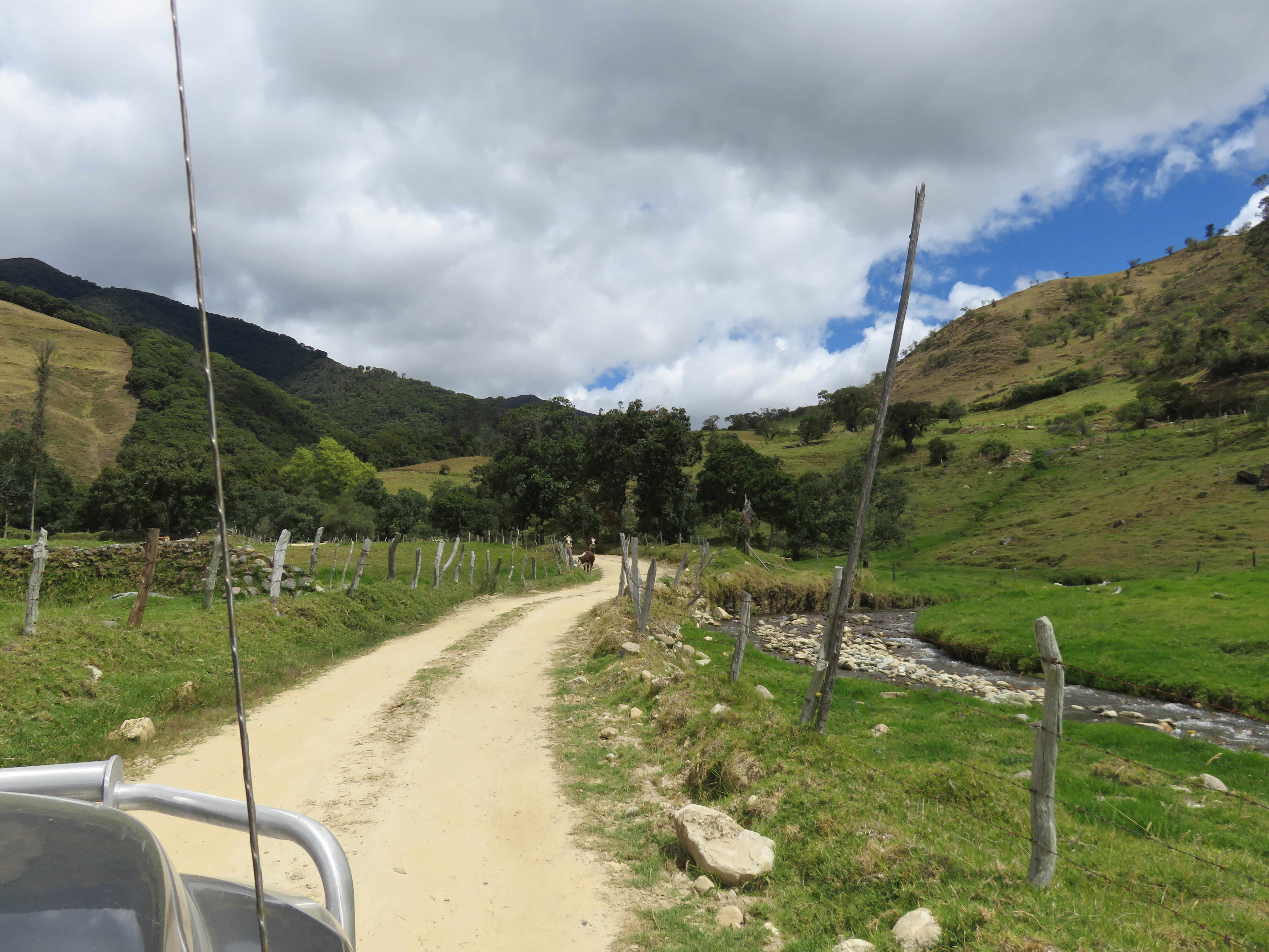
The road (64) from Onzaga south was closed and the smaller one heading east to Soata we were told is in very bad shape and washed out. We asked some men in the church square of Onzaga about an alternative and they told as a different way to drive. This route was not in our GPS and online maps, in the “real” map it was marked as a trail. Ok, we went, one can always turn around if it is not doable. Lucky we talked to those men, because this road was very, very beautiful, it follows a river all the way up to 3000 meters, through a lush valley with fields of onions, potatoes, tobacco, fava beans, cows and sheep, people with heavy wool ponchos (ruanas) and children on horses. This road meets up with the main road (55) again near Paramo.
Potato harvest.
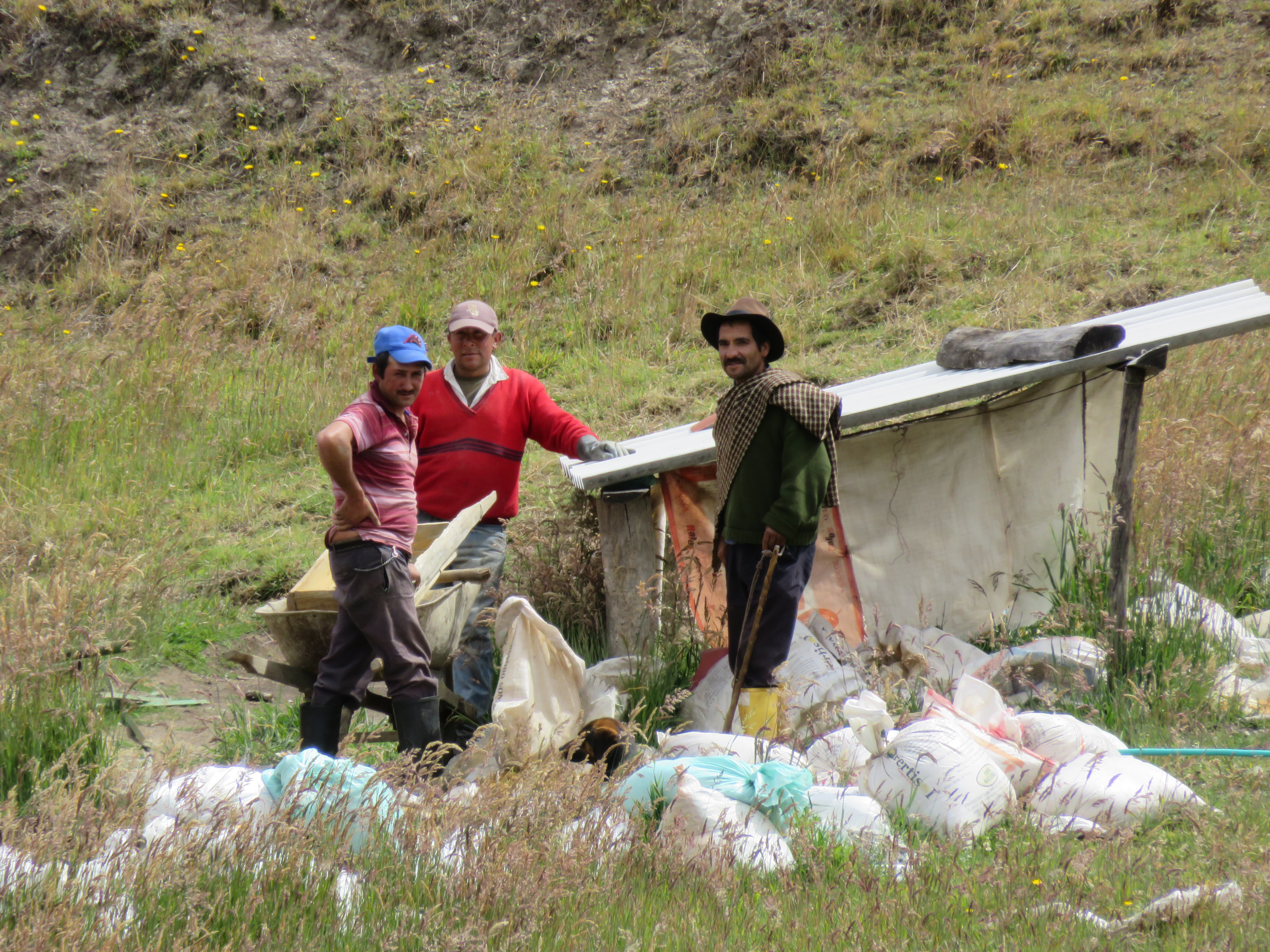
Günter stopped to put air in the tires and I took some pictures of the surrounding farms and the potato harvest when oops, I looked through the view finder (my camera has one )and there were soldiers heads popping up in a field. I talked to a drunk worker and he told me there are quite a few soldiers hidden in a nearby farm-house ruin, gully and that field.
There is also heavy military presence on the southern end of highway 64 and we were not allowed to camp there, when I was wandering through an area of frailejones I was stopped by several soldiers and told to leave immediately because it is not a safe area.
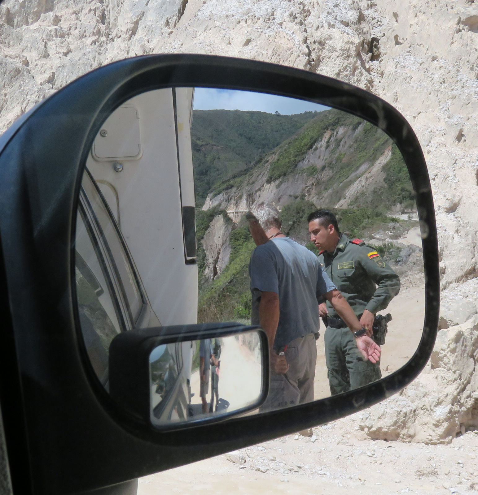
Colombia has had a rough time with FARC and other guerilla groups making large areas of the country unsafe, nevertheless, it has gotten much better since the ’80s and ’90s and the areas still largely occupied by FARC are shrinking and well-known, so you do not and cannot go there.
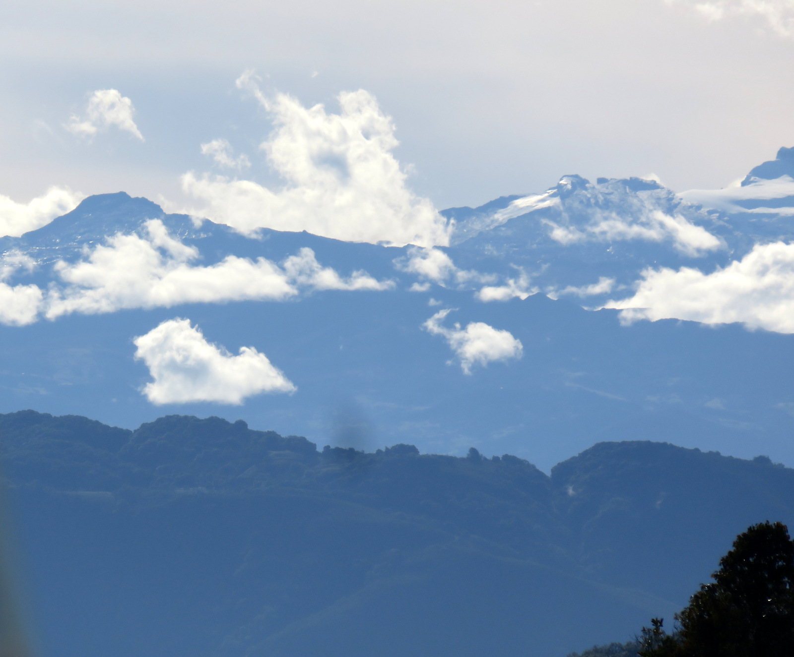
Time to find the glaciers and snow-covered peaks of the northern Andes and on to Cocuy.

Hallo Sissi, das ist wieder ein Wahnsinns-Bericht. Du musst ein Buch schreiben!! Und die wunderschönen Fotos, eine andere Welt!!!!!
Ihr seid schon sehr mutig, aber sicher sind ein paar Schutzengel dabei!
Heute sind wir zu den Festspielen auf die Seebühne mit Dinner eingeladen ..Momentan haben wir um die 34 Grad!!! Bade wetter, zum biken leider zu heiß!!
Liebe Grüße
Helga
_____
LikeLike
Danke Helga, es ist wirklich wunderschön hier, komme fast nicht nach mit aufschreiben.
LikeLike
Your adventure gets more amazing with each post! Thank you for sharing your very personal experience of South America (so far) with us. Keep it going, as we will follow you all the way south, then north again! And the writing and photos are really outstanding! Bien hecho, amigas! Buen viaje!
LikeLike
Thanks Judi, it is a beautiful country, we had no idea….
LikeLike
Sissi you are beautifull! Gunther you too but less than Sissi
LikeLike
Haha Bernard, you must have heard us laughing out loud when I read your comment to Günter! Thanks for the compliment.
LikeLike
When you eventually get to Popoyan , stay at the hotel El Convento…at least in their parking lot ! Across the street is the great little resto , Itailiana….owned by Cbristine , a Swiss German aus Basel .
Anyway , great story and adventure you are having . Colombia is the best country in SA for so many reasons . I too have done your same itinerary , but on a moto .
Tschus , william .
LikeLike
Thanks Willi, we’ll do that.
LikeLike
Thanks for this great post. It feels as if we are right there with you! I am so glad you are taking each opportunity for personal interaction. BTW- we are headed to Alaska now!
LikeLike
Thanks you two. We have been following your journey as well. Happy Birthday.
Summer leaves early in Alaska, so drive up fast and do more sightseeing on the way down.
Denali closes mid Sept. I think. Great travels for you.
LikeLike
Mensch, sissi und gü, uaaah! Guat luaget r us!!!
Nömma lang! Mir send ja scho so uufgregt 🙂 aibe gschichtle mached d Schmetterling allig no größer …
xxx aibe schäärabande
LikeLike
Ja ihr werdets schööha da bin i sicher. Frei mi für eib. Freied önsch au dass ihr da iichegluaged heid.
LikeLike
You both are having the time of your lives. I’m so happy for you and also very jealous. The pictures are wonderful. Thanks for including us. Hope to see you one of theses days. Still going to Austria the end of January. Love you Joan & Mike
LikeLike
So enjoy posts of your adventures! Thank you for brightening my day. Hope to see you next summer back in Juneau!
LikeLike
Toller Bericht ( lerne fleissig Englisch!!) und traumhafte Fotos!
LikeLike